









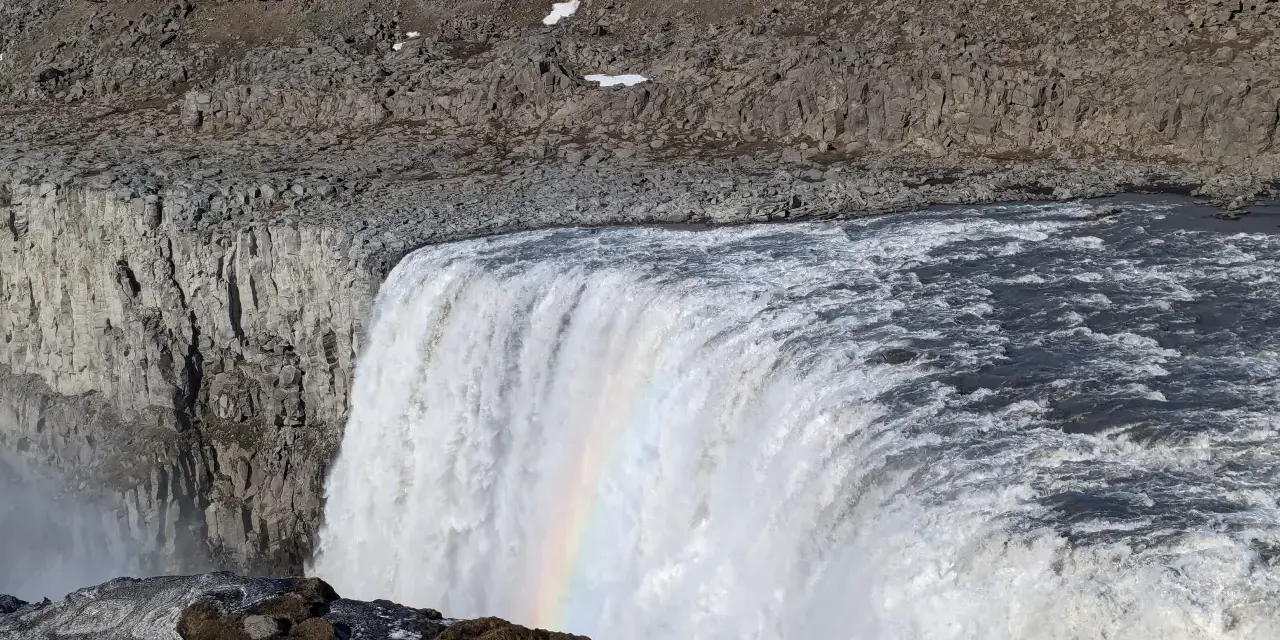
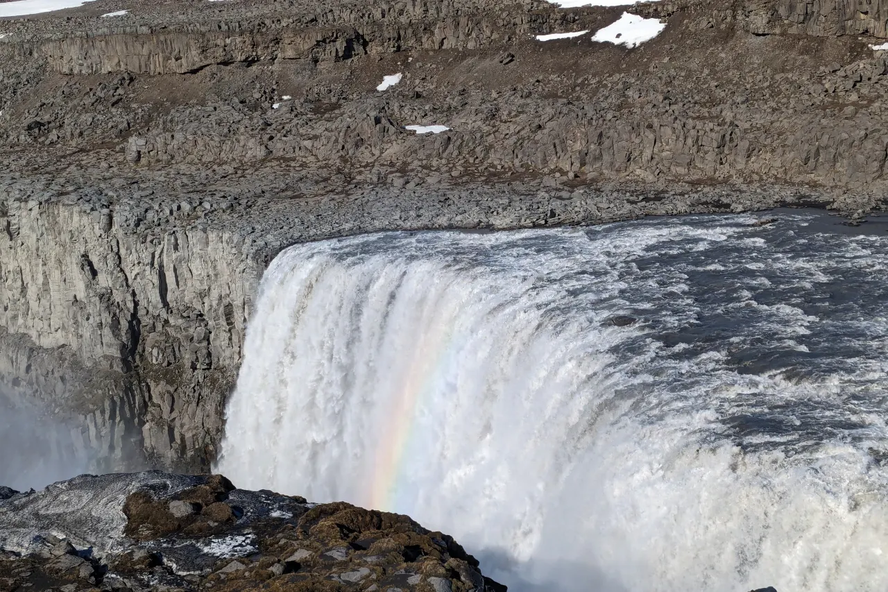
You hear Dettifoss before you see it — a low rolling thunder rising from the canyon floor while the path is still crossing lava fields — and you feel it before you reach the rail: a vibration in the ground and a drift of spray that soaks your jacket in July. This is Europe’s most powerful waterfall by volume, an average of roughly 193 cubic metres of glacial water per second plunging about 44–45 metres over a curtain roughly 100 metres wide. Our team has stood on both banks in melt-season flood, autumn frost and February’s brief grey daylight; this guide covers the whole visit — which bank to choose, the Selfoss and Hafragilsfoss walks, the roads that decide your day, and the safety habits the unfenced rim demands.
Dettifoss is also the anchor of a full northeast day: the horseshoe of Selfoss a kilometre downstream, the canyon country of Jökulsárgljúfur — part of Vatnajökull National Park — and the combined loop with Ásbyrgi canyon and Húsavík’s whale bay. It is a straightforward visit made complicated only by distance and weather.
Punti chiave
- Scale, not height: Dettifoss is Europe’s most powerful waterfall by average flow — around 193 m³/s pouring roughly 44–45 m over a ~100 m wide curtain.
- Two banks, two moods: the east bank (road 862, paved) offers platforms over the gorge; the west bank (road 864, gravel) puts the fall face-on. Visit both if time allows.
- Selfoss is the quiet masterpiece: about 1 km downstream, a wide elegant horseshoe roughly 10 m high that many travelers end up preferring.
- Free and open all day: no entry fee, viewing platforms on both banks, and peak flow in late July–early August when the glacial melt maxes out.
- The edges are real: guard rails stop well short of the rim in places — respect the fences, the wet rock and the spray zone, and keep children within reach.
Risposta rapida: from Mývatn it is 45 minutes to an hour; from Akureyri about 1.5–2 hours. Do the east bank first (paved road 862, main platforms), walk the 1 km to Selfoss, then cross to the west bank (road 864, gravel) for the face-on view and the Hafragilsfoss detour. Peak flow runs late July to early August; in winter, check road.is before you commit — access is limited and sometimes closed.
Why it is Europe’s most powerful waterfall
Power in a waterfall is a volume claim, not a height claim, and Dettifoss wins it the honest way: the Jökulsá á Fjöllum, Iceland’s second-longest river, drains Vatnajökull and funnels through a narrow canyon section to drop in one curtain. The average flow of roughly 193 cubic metres per second makes it Europe’s most powerful waterfall by volume. On peak melt days in late July and early August, when the glacier surrenders its summer, the falls visibly widen and the sound changes register from roar to permanent thunder.
The water itself explains the look. Glacial rivers carry “rock flour” — stone ground to silt by moving ice — so Dettifoss pours grey-brown most days rather than the turquoise of spring-fed falls. Do not be disappointed; the colour is the power. The whole system belongs to the Jökulsárgljúfur canyon, whose staircase of falls reads like a geology textbook: floods from ancient eruptions beneath the glacier carved the gorge, and the walls still carry the terraces of those megafloods.
Worth knowing: the famous opening of the film “Prometheus” was filmed at Dettifoss — east bank, winter, the falls frozen into a black-and-white sculpture. The movie made the spot internationally famous, which is exactly why the morning visit matters.
East bank vs west bank: choosing your viewpoint
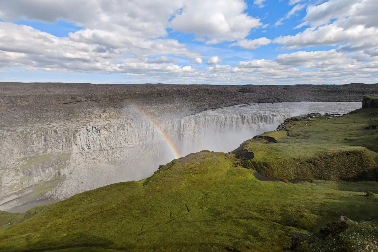
The river divides the experience in two. The east bank is reached by road 862, paved all the way from the Ring Road, and hosts the main developed viewpoints: short walks from the car parks to platforms set over and beside the gorge, where the full curtain shows in profile and the spray throws rainbows on sunny days. This is the bank to do first: easy access in any car, maintained paths, and both Dettifoss and the Selfoss walk within an easy loop.
IL west bank, reached by gravel road 864 from the Ring Road, delivers the face-on view — the whole width of the fall in front of you, spray drifting back over the rim, and a wilder, less-built feel to the paths. Photographers argue about the banks the way locals argue about weather; our honest answer: the east side wins for platforms and access, the west wins for drama — the sense of standing opposite a force rather than beside it. Roads differ too: 862 is usually passable well into the season for any car, while 864 stays rougher and closes earlier in autumn. Check road.is for both — the two sides can be in different states on the same day.
- East bank (road 862): paved, main platforms, easiest with any vehicle — start here.
- West bank (road 864): gravel, face-on views, rougher road and earlier seasonal closure.
- Both banks: no fee, open all day in season; combine with the Selfoss walk for the full visit.
Selfoss and Hafragilsfoss
Follow the marked path downstream from the east-bank platforms for about a kilometre and the canyon opens into the surprise of the trip: Selfoss, where the river drops only about 10 metres in a wide, braided horseshoe — a smaller, more elegant cousin of Goðafoss. Where Dettifoss overwhelms, Selfoss composes; it is the fall photographers linger on and the one our team quietly prefers. The walk is easy gravel, and the return completes a tidy hour-or-so loop from the east-bank car park.
Farther downstream, Hafragilsfoss drops from the river’s next terrace — visible from a viewpoint on the road toward the delta, and dramatically framed by the canyon walls. A short drive rather than a walk from the main stops keeps its crowds thin. The full northeast day then builds itself: Dettifoss and Selfoss in the morning, the drive north through Jökulsárgljúfur with a Hafragilsfoss stop, Ásbyrgi at the delta for lunch, and — if the day allows — Húsavík for an evening whale sail. The Húsavík guide picks up exactly there.
Planning the visit: roads, access, timing
The arithmetic first: Dettifoss sits about 45 minutes to an hour’s drive from the Mývatn district, and roughly 1.5–2 hours from Akureyri. Entry is free and the platforms are open all day in season; a basic visit — east bank platforms plus the Selfoss walk — fits comfortably in 1.5–2 hours. Facilities are minimal by design: car parks, paths, signs and wind. There is no café at the falls worth planning around, so fuel and food come from Mývatn, Ásbyrgi or Akureyri, and the wind deserves its own line item: a real shell jacket, because the spray zone does not negotiate.
Timing beats almost everything here. Midday in July delivers the biggest crowds on the east-bank paths; early morning and evening deliver the falls alone, with side light on the canyon. The melt-season peak in late July and early August is the waterfall at maximum power but minimum solitude; September splits the difference with thinner crowds and autumn colour in the canyon. The one thing to build into every plan is a weather check: wind warnings and storms can close roads on either bank without much notice, and road.is is the authority.
Da viaggi reali: the falls are spectacular in rain and miserable in gale — the difference is entirely wind speed. On an orange wind warning, swap the canyon for a Mývatn day and retry tomorrow: the waterfall is not going anywhere, but the car door you lose to a gust will cost more than the detour.
The canyon: Jökulsárgljúfur and Ásbyrgi
Dettifoss is the headliner of Jökulsárgljúfur, the canyon section of Vatnajökull National Park that runs from the falls down to the sea at Öxarfjörður. The park status matters practically as much as poetically: drones need permits and are generally prohibited without them, paths are protected, and the rules exist because the canyon’s ecosystem is genuinely fragile. Treat the park signs as the law they are — the terraces above the river hold evidence of megafloods and human history, and neither recovers from shortcuts.
The canyon’s northern end is Ásbyrgi, a horseshoe depression up to about a kilometre wide with sheer cliff walls and a floor of unexpected woodland — in Icelandic legend, formed by the hoofprint of Odin’s eight-legged horse Sleipnir as he touched the earth. It is a completely different register from Dettifoss: green, quiet, walkable, with ponds and birch instead of spray and basalt. The drive between the falls and Ásbyrgi follows the canyon edge, and the whole northeast day — falls, canyon walls, delta forest — is one of the country’s most under-planned itineraries.
Photography and safety at the rim
Two rules govern photography at Dettifoss: the spray and the edge. The spray means protective gear — a lens cloth in a pocket, a bag that closes, and the certainty that the west bank in any wind will mist your front element within minutes. The edge means respect: the platforms end and the unfenced rim begins, the rock near the falls is wet, and the drop is lethal. Guard rails stop short of some viewpoints by design; the fences that exist are not suggestions. Keep to the paths, keep children by the hand, and get your dramatic rim shots with feet well back from any overhang.
For the image itself: the east-bank platforms give the classic profile with the falls in cross-light at either end of the day; the west bank gives the frontal composition where the whole curtain shows. A wide lens earns its place at the platforms; a mid-zoom works from Selfoss; polarizers cut the spray glare. Drones are off the table inside the national park without explicit permission. And in winter, when the falls freeze into the black-and-white structure the movies love, every surface near the rim is ice: the platforms are the only option, and crampons become photography equipment.
Seasons: melt, autumn, winter and aurora
Summer (June–August) is maximum power and maximum access: both banks open, peak flow in late July–early August, long daylight that makes evening visits easy — and the season’s maximum people. Go early. Autumn (September–October) is our team’s pick: the river still runs heavy, the canyon mosses turn copper, the crowds thin with the weather, and the first clear nights bring something rare — on clear autumn nights the aurora has been known to stand directly over the falls, turning the riverside car parks into tripod city.
Winter (November–March) shrinks the map: roads to one or both banks may be unplotted or closed for stretches, the east-bank paved route usually holds out longest, and the falls themselves freeze into the sculpture that made them famous. Access is limited and changeable — check road.is the day of, not the week before, and treat a closed road as final. The reward, when the window opens: white-and-black falls under winter light — and if the en.vedur.is forecast aligns, an aurora over the canyon that justifies every layer you wore. Spring (April–May) is the shoulder nobody books: melt beginning, roads reopening unevenly, and the first birds returning to the cliffs.
Frequently asked questions
Which side of Dettifoss should I visit?
The east bank (road 862, paved) for the main platforms and the Selfoss walk — it is the easiest and most developed side. The west bank (road 864, gravel) for the face-on view and wilder feel. With time, do both; with one choice, take the east bank unless the photograph demands the front view.
Is Dettifoss free to visit?
Yes — entry is free and the viewing platforms are open all day during the access season. The costs of the visit are transport, time and clothing; there is no ticket booth, and facilities are deliberately minimal.
Can you get close to the edge of the falls?
The platforms put you close enough for the full experience, and beyond them the rim is unfenced in places — which is precisely why you should stay behind the rails and paths. The rock is wet, the drop is real, and the spray makes surfaces treacherous.
Is Dettifoss accessible in winter?
Limited and weather-dependent. The paved east-bank road usually receives priority plotting, but closures happen and the west-bank gravel road closes earlier and longer. Check road.is on the day, expect ice on every surface, and consider a guided winter tour if the drive itself is outside your comfort zone.
How long should I plan for a Dettifoss visit?
An hour and a half to two hours covers the east-bank platforms plus the Selfoss walk. Add the west bank and Hafragilsfoss for a fuller half-day, and build the northeast circuit — falls, canyon drive, Ásbyrgi, Húsavík — into a long day or an overnight. From Mývatn the drive is 45 minutes to an hour; from Akureyri, roughly 1.5–2 hours.
Anchor the falls in a real itinerary
Dettifoss is the hinge of the northeast loop — Mývatn’s geothermal country lies an hour west, Húsavík’s whale bay the same distance north.
For the country’s other big water, the great waterfalls of Iceland ranks the unmissables, the Húsavík guide finishes the northeast loop properly, and our weather & wind guide keeps the driving days honest. If the falls have you considering the whole circuit, start with the Ring Road driving guide.
Sources & official references
- Official Icelandic services: road.is (roads 862/864 status and seasonal plotting), en.vedur.is (weather, wind and aurora forecasts), safetravel.is (canyon and rim safety) — checked 2026.
- Vatnajökull National Park visitor information: Jökulsárgljúfur canyon, protected-area and drone rules; park inquiry line +354-5758400.
- Trip.com Iceland destination guide (checked 2026): Dettifoss listing (free entry, open all day), flow and dimension figures (~193 m³/s, ~44–45 m, ~100 m), northeast itineraries; Icelandic geology sources for the Jökulsá á Fjöllum catchment and the canyon’s megaflood history.
- Editorial visits across seasons 2024–2026 by the Iceland Travel Guides team.
