









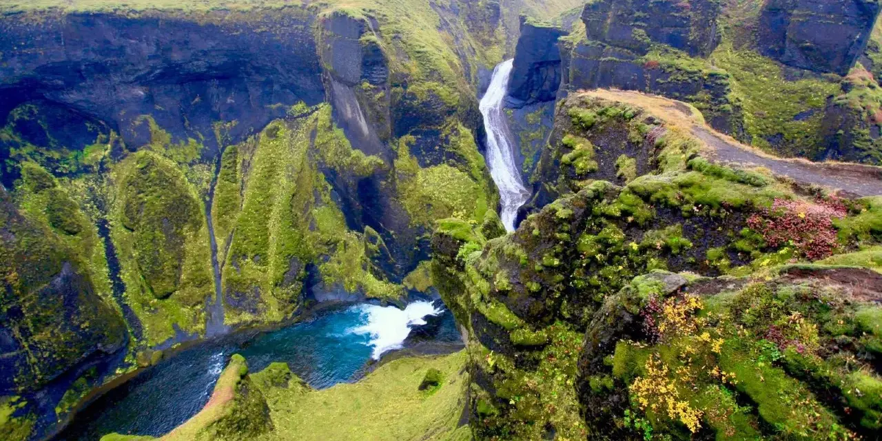
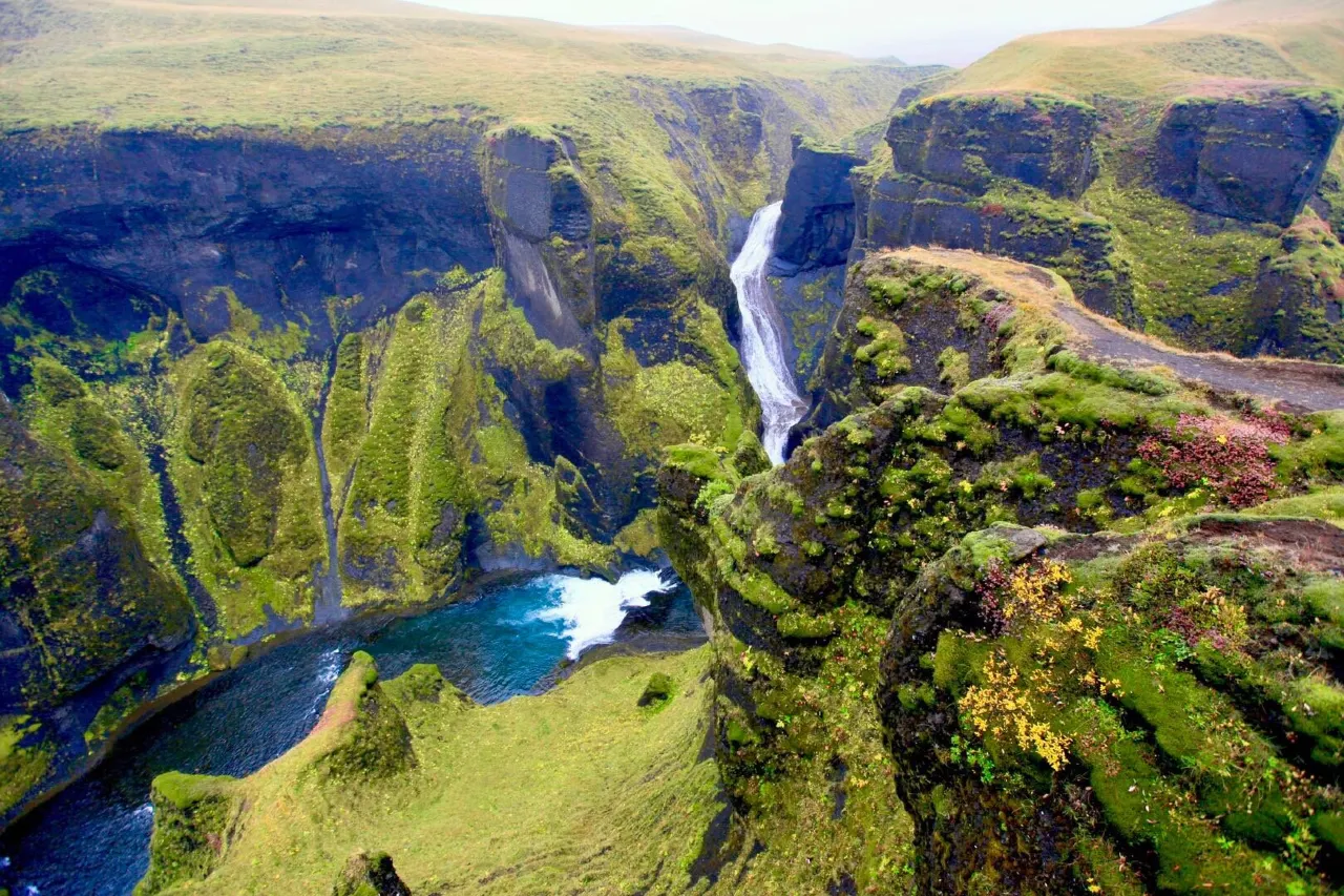
Five minutes off the Ring Road, in the moss-green country east of Kirkjubæjarklaustur, the ground simply opens. Fjaðrárgljúfur is a two-kilometre slash through the earth, about 100 metres deep, its serpentine walls draped so thickly in green moss that the canyon looks less carved than knitted. The Fjaðrá river threads along the bottom in slow blue loops while you walk the rim above, moving from viewpoint to viewpoint as the canyon twists and reframes itself. Our team ranks it among the top free stops in south Iceland — with one important caveat about how you walk it, which this guide explains in full.
The canyon is also a case study in modern Icelandic tourism: a quiet local secret that a single pop video turned into a global landmark, complete with trail erosion, a temporary closure and a careful reopening. Understanding that arc is part of visiting well. Below you will find the geology, the practical visit plan, the photography windows, and the surrounding stops — Eldhraun’s lava moss fields and the highland road east — that turn a 45-minute stop into a proper day.
Key takeaways
- Compact and deep: roughly 2 km long and about 100 m deep, carved by the Fjaðrá through soft palagonite and tuff since the last ice age.
- Effortless access: about five minutes off the Ring Road near Kirkjubæjarklaustur; entry is free and the site is open year-round.
- The walk is gentle: a rim path with a chain of viewpoints; 30–60 minutes at photo pace, flat enough for most abilities.
- Stay on the path: the moss is fragile and recovers slowly; heavy foot traffic closed the canyon temporarily in 2019, and it reopened with reinforced trails.
- Light matters: afternoon through sunset warms the walls; midday flattens them. Overcast is underrated for the green-on-green palette.
Quick answer: plan a 45–90 minute stop. Walk the rim path end to end, keep to the marked trail, and aim for late afternoon when the light warms the moss and the day-trippers have moved on. Pair it with the Eldhraun lava field just west and, on a longer itinerary, the highland road that climbs toward the Laki craters.
How the canyon was carved
Fjaðrárgljúfur is young by canyon standards and old by human ones. Its walls are palagonite and tuff — compressed volcanic ash that is soft enough to cut — and the Fjaðrá, fed by meltwater from the glaciers and moorlands to the north, has been sawing through them since the last ice age released the water. Two kilometres doesn’t sound like much until you stand on the rim and watch the river double back on itself below; the canyon’s serpentine curve is the water’s autobiography, written one meander at a time.
The moss is the second author. South Iceland’s maritime climate keeps the palagonite damp, and the walls have grown a pelage of mosses, grasses and low scrub so complete that the rock almost disappears. This is why the canyon photographs unlike any other in the country — and it is also why the site is managed carefully. Soft rock plus soft vegetation equals a trail system that can only take so much, which is exactly what the next section is about.
Worth knowing: the canyon floor is not part of the visit. There is no maintained path to the river, the banks are soft and slippery, and the best views of the Fjaðrá’s loops come from the rim anyway. Treat the rim path as the only route and the experience loses nothing.
Visiting: the rim path & viewpoints
The visit could hardly be simpler. Park at the signed area by the site, and a path runs along the canyon rim with a sequence of natural platforms and viewpoints. The first overlooks deliver the classic profile shot almost immediately; the further you walk, the more the canyon’s twists hide and reveal the river, until the path ends where the canyon opens toward the lowlands. Most visitors see the first two or three viewpoints and turn back — walking the full line adds little time and much reward.
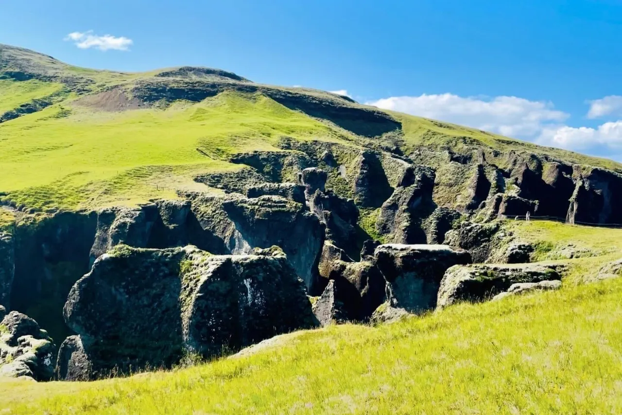
Wear shoes that can cope with damp gravel and expect wind along the open rim. The path is well-maintained and reinforced at the pinch points; there are stairs in steeper sections. Budget 30 minutes for the short version and an hour for the full walk with photographs — and note that the parking area fills on midsummer afternoons, so a morning or evening arrival changes the feel of the whole visit.
The 2019 closure & visiting gently
Here is the part of the story every responsible visitor should know. In 2015, a music video — Justin Bieber’s “I’ll Show You”, shot partly on and around the site — introduced the canyon to a global audience. Traffic rose steeply, and by 2019 the footpath erosion had grown severe enough that environmental authorities temporarily closed the canyon to let it recover, with a further spring closure in 2020. It reopened with reinforced paths and clearer management, and it has stayed open since.
The lesson is not “don’t visit” — it is that the site’s future depends on visitors treating a soft landscape as soft. Keep to the marked path even when the moss beside it looks inviting (it recovers slowly, over years, not weeks), keep drones grounded unless you are following the national rules — maximum 120 metres altitude, line of sight, 150 metres from public buildings — and skip scrambling down the walls entirely. The habits in our responsible travel guide apply in miniature here: the canyon stays beautiful precisely because each walker chooses the path over the shortcut.
From real trips: the single biggest quality upgrade is timing. We have seen the first overlook shoulder-to-shoulder at midday and utterly silent at 21:00 on a June evening, when the low sun turned the moss gold and the river ran like poured glass. Same trail, same day, different planet — go late.
Light & photography notes
Afternoon through sunset is the headline window: the western light rakes down the canyon axis, warms the moss and drops the river into contrast. Overcast, meanwhile, is the connoisseur’s choice — saturated greens, soft even light, no hot spots on the walls. Midday in high summer is the weakest light and the biggest crowd, a double discount. In autumn the moss stays green while the surrounding moor turns rust, and the color contrast peaks.
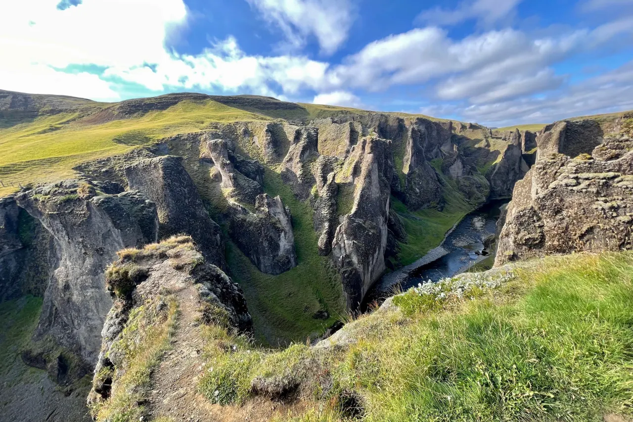
Compositionally, the money frames are: the classic profile from the first overlooks (canyon curve plus river loop), the tight verticals where side streams spill over the rim, and the end-of-path shot where the canyon opens and the river runs toward the lowlands. Long lenses compress the bends; wide lenses need foreground moss to avoid empty-frame syndrome. Keep tripod legs inside the path line — the edges are softer than they look.
Eldhraun, Kirkjubæjarklaustur & the Laki road
The canyon anchors a rewarding corner of the south. Just west lies Eldhraun, one of the world’s largest lava fields, blanketed in the same moss that dresses the canyon walls — a twenty-minute drive and a completely different scale of the same aesthetic. The village of Kirkjubæjarklaustur, minutes away, is the practical service point: fuel, food, and accommodation at the edge of the country’s largest national park territory.
East of the village, the road toward the Laki craters climbs into the highlands — the route of the catastrophic 1783–84 fissure eruption that reshaped both Iceland’s landscape and its history. It is a highland road with highland rules: summer-only, weather-dependent, and best combined with the expertise in our Landmannalaugar & highlands guide. Even a partial drive into that country puts the canyon’s soft green into geological context: the moss you are walking over is the aftermath of fire.
When to go
Summer is the full-color season — moss at maximum green, long evenings, and the midnight light that makes the late-day windows stretch for hours. Expect midday crowds on the early viewpoints. Winter keeps the site open and transforms it: snow dusts the moss, ice trims the river, and the crowds evaporate — but the rim can be icy, so traction devices are sensible and daylight is short. Shoulders (May, September–October) balance color, quiet and daylight best of all. In every season, the site’s open-year-round access means the weather, not the calendar, is the real gatekeeper — check en.vedur.is before setting out.
Frequently asked questions
Why was Fjaðrárgljúfur closed in 2019?
After the canyon’s appearance in a 2015 music video drove visitor numbers steeply upward, footpath erosion on the fragile moss and soft palagonite grew severe enough that authorities closed the site temporarily in 2019 (with a further spring closure in 2020) to let it recover. It reopened with reinforced paths and continued to stay open under standard trail rules.
Is the canyon open year-round?
Yes — the site is free and open year-round, with no seasonal gate. The practical limits are winter daylight, icy patches on the rim, and occasional storm days; check the forecast and road status before a winter visit and bring traction in frost.
How long is the walk, and is it hard?
The rim path runs with a series of viewpoints and takes 30–60 minutes at a photo pace, with some stairs and gentle climbs. It is suitable for most abilities and older children; the surface can be damp, so shoes with grip matter more than boots.
Can you climb down to the river?
No — there is no maintained path to the canyon floor, the banks are soft and slippery, and the walls erode underfoot. Every good view of the Fjaðrá’s loops comes from the rim, which is precisely why the site asks visitors to keep to the marked trail.
What should I pair it with on a south-coast drive?
Eldhraun’s mossy lava field to the west and Kirkjubæjarklaustur for services are the natural companions; the Laki craters highland road extends the theme for travelers with extra time and the right conditions. Further west, the classic waterfalls make a strong second half of the day.
Where the canyon sits in the bigger drive
Slot Fjaðrárgljúfur into a Ring Road day with our route-by-route planning guide.
Keep exploring the water theme: the island’s headline cascades are ranked in our top-10 waterfalls guide, the walk-behind classic lives in our Seljalandsfoss guide, the 60-metre thunder of Skógafoss gets its own day in the Skógafoss guide, and our winter travel guide covers the traction-and-daylight math for cold-season canyon walks.
Sources & official references
- Official Icelandic services: road.is (Ring Road and highland-road status), en.vedur.is (weather forecasts), safetravel.is (outdoor safety guidance) — checked 2026.
- Trip.com Iceland destination guide (checked 2026): Fjaðrárgljúfur listing — open year-round, free access, visitor ratings and recommended visit length.
- Environmental management background: the canyon’s 2019 temporary closure for trail recovery, spring 2020 closure and subsequent reopening with reinforced paths, as publicly reported.
- Geology background: published descriptions of the canyon’s palagonite/tuff walls, post-glacial carving by the Fjaðrá river and approximate dimensions (~2 km long, ~100 m deep).
- Editorial visits by the Iceland Travel Guides team across seasons, most recently 2025–2026.
