









The Westfjords are what Iceland looks like when you remove the tour buses. A huge horn of ancient basalt jutting into the Denmark Strait, the region holds some of the country’s grandest sights — a hundred-metre tiered waterfall, a ten-kilometre golden beach, bird cliffs that stretch beyond the horizon — and almost none of the infrastructure that usually follows them. Reaching it takes commitment: five to seven hours of driving from Reykjavik, or a ferry shortcut across Breiðafjörður. Our team keeps going back anyway, because the rewards compound the farther you push: empty roads that behave like private drives, villages where the fish factory is the biggest employer and the newest building, and a silence so complete you can hear the tide change.
This guide is the honest map to the region: the sights that justify the detour, the roads that deserve respect, the ferry that halves the loop, and the two-to-four-day itineraries that actually work. If your Iceland trip has one spare corner of slack, this is where we would spend it.
Points clés à retenir
- Dynjandi is the region’s icon: a roughly 100-metre tiered cascade of six or seven falls, free to visit, reached on a 15-minute mossy approach walk.
- Látrabjarg is the big-ticket wildlife site: a 14-kilometre bird cliff up to roughly 441 metres high — Europe’s westernmost mainland point and a summer puffin metropolis.
- Rauðisandur is unique in Iceland: around 10 km of golden-red sand instead of black — with a steep access road that filters out the crowds.
- Ísafjörður is the base town: the regional capital of about 2,600 people, with an airport, real services and the fjord system of Ísafjarðardjúp around it.
- Plan for thin services: gravel 600-numbered roads, sparse fuel stations and a summer-best season — two to four days is the right trip length.
Réponse rapide : give the Westfjords two to four days. With two, drive in via Route 60, see Dynjandi and Rauðisandur, sleep in Ísafjörður, visit Látrabjarg on the way out. With three or four, add the ferry crossing from Stykkishólmur to Brjánslækur and the small-town detours — Bolungarvík’s maritime museum, Þingeyri’s old stone church. Summer is the only realistic season for a first visit.
Why cross the fjords at all
Westfjords geography explains everything about Westfjords travel. The peninsula is one of the oldest rock surfaces in Iceland — millions of years of erosion have softened what the rest of the island keeps raw — and the coastline folds into dozens of fjords, each with a road that must climb over one headland and drop into the next. Distances on the map lie by half. This is precisely the charm: the region cannot be “done” quickly, so almost nobody tries, and the traveler who arrives finds Iceland roughly as the sagas left it.
The payoff list is genuinely world-class. Dynjandi is the country’s most photogenic waterfall system after the famous south-coast trio. Látrabjarg hosts seabird colonies of national-importance scale, with puffins at arm’s length in summer. Rauðisandur is the only major beach in Iceland where the sand forgets to be black. And the towns — Ísafjörður above all — offer the fish-and-quiet version of Icelandic life that the Ring Road long ago traded for convenience. The honest trade-off list is short but real: long drives, thin services, and weather that can strand plans for a day.
Getting there: road vs ferry
Two ways in, and smart itineraries use both as a loop. By road, the drive from Reykjavik takes roughly five to seven hours depending on your line — up Route 60 over the high passes into the fjord country, or the southern approach through Brjánslækur. The interior legs are the memorable ones: narrow, winding, gravel in stretches, with the 600-numbered side roads climbing to viewpoints that feel like secrets. Most are fine in a standard car driven slowly, but check road.is before you commit, fill the tank whenever you see a station, and treat the passes with the respect their width deserves.
By sea, the Baldur ferry runs from Stykkishólmur on the Snæfellsnes side to Brjánslækur on the southern shore, a crossing of roughly two and a half to three hours through the islands of Breiðafjörður. It turns a Ring Road circuit into a proper loop — Snæfellsnes in the morning, Westfjords by afternoon — and the sailing itself is an attraction: seabirds, scattered islets, and the strange satisfaction of watching the car deck load by itself. Sailings vary by season and day; check the timetable when you build the trip.
Worth knowing: book the ferry vehicle space in advance in July–August and arrive early — the queue boards in order. If the crossing is rough, the inner lounge fills fast; jackets and sea legs win the deck.
Dynjandi: the jewel of the Westfjords
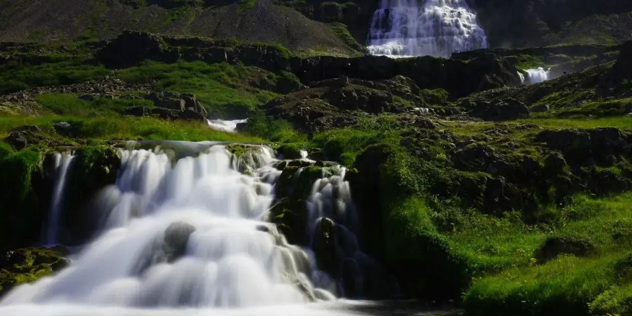
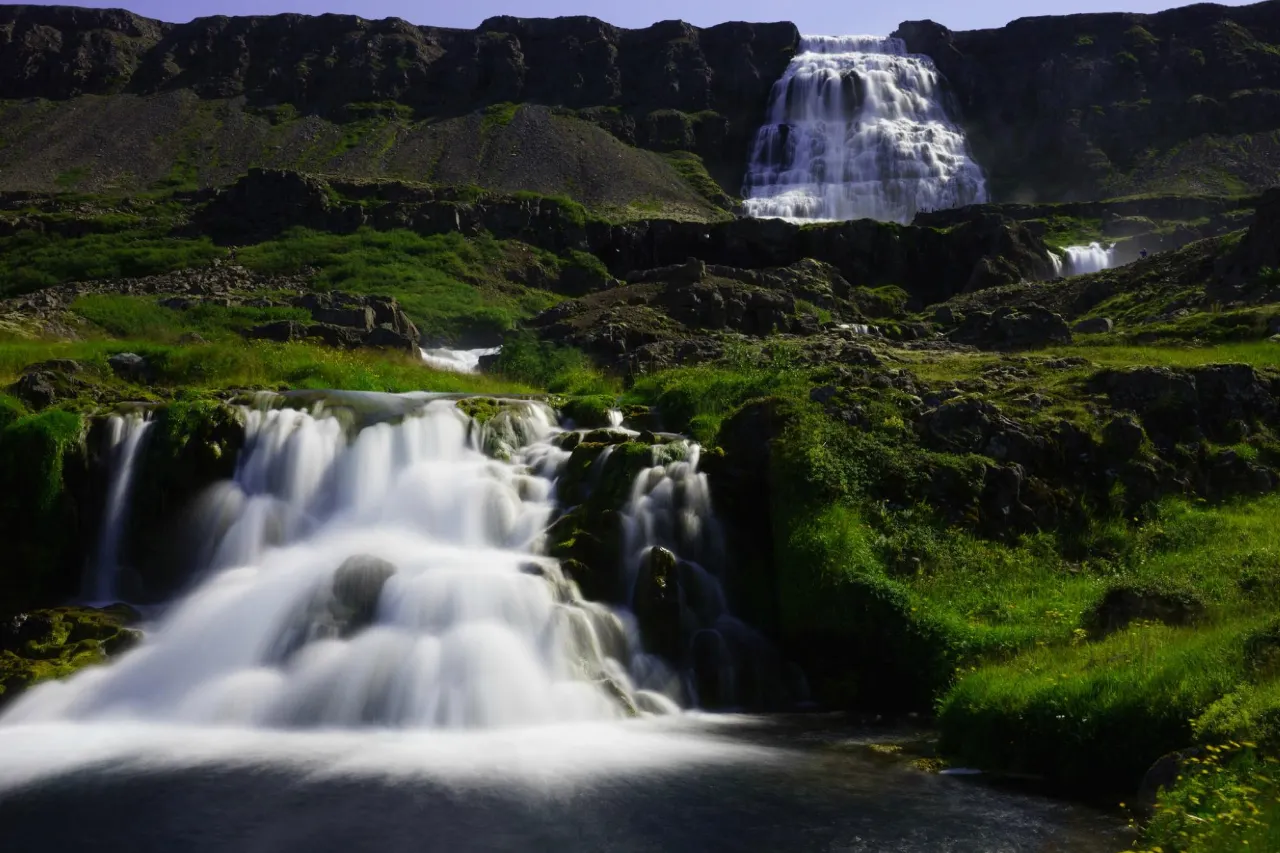
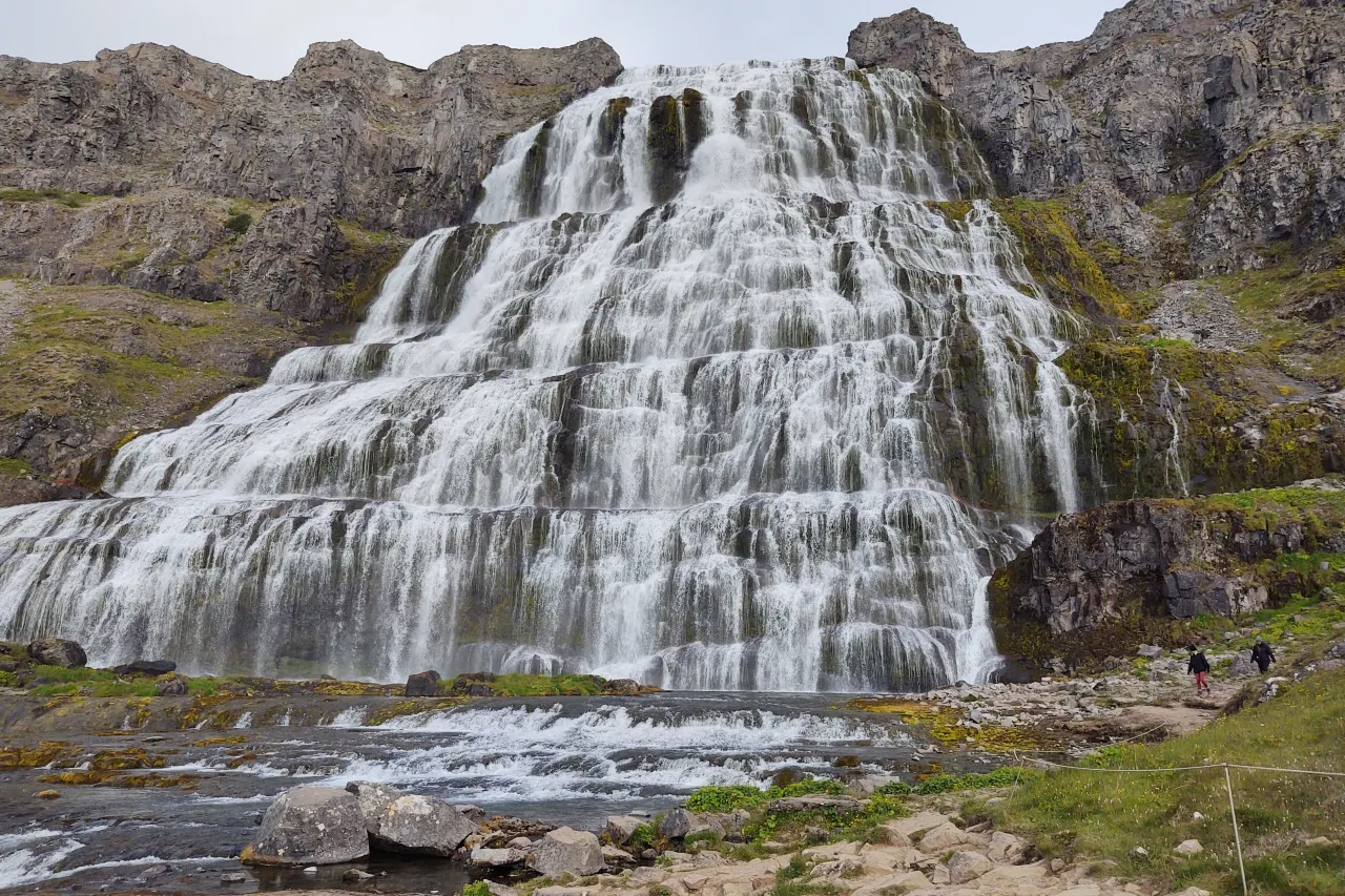
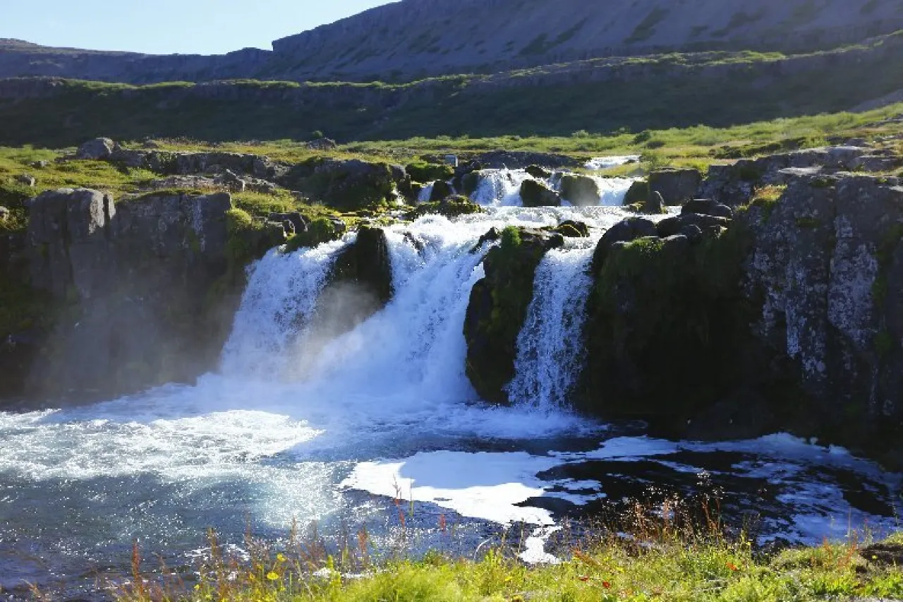
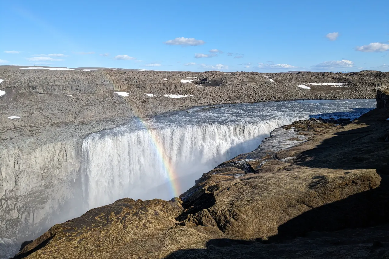
Dynjandi — also called Fjallfoss — hangs on the face of the fjord like a wedding veil pulled in layers. The main fall drops roughly 100 metres, widening as it falls, and below it a staircase of six or seven smaller falls (Bæjarfoss, Hundafoss and their siblings, named after the brides of local legend) steps down toward the shore. The whole system thunders, hisses and sprays in a way photographs refuse to convey; the sound reaches you before the parking area does.
Access is free and honest: a well-kept path climbs from the car park through moss and boulders to the base of the main fall in about 15 minutes, with better vantage points at every tier. There are no fences and no rangers shepherding you — the rock near the falls is wet, slick and slippery, so treat the moss like ice and keep children within reach. Summer brings midges; the wind usually handles them. Winter closes the road over the pass more often than not, which is why the region’s icon stays a summer memory for almost everyone.
Rauðisandur: the golden-red beach
Iceland’s beaches are famously black — except here. Rauðisandur stretches roughly 10 kilometres along the southern coast, its sand shifting from gold to pink-red depending on the light, backed by dunes and the pale shell drift that gives the beach its colour. On a sunny day it looks like a different country; on a moody one, like the surface of some older planet. Either way, you will share it with birds, seals on the far headlands and perhaps a handful of other visitors.
The filter that keeps Rauðisandur quiet is the access road: a steep, narrow descent with switchbacks that discourages long vehicles and rewards patience. Take it in low gear, keep to the right, and remember the return climb. There are no facilities of note at the beach and no lifeguards ever — the North Atlantic here is cold, powerful and unguarded, so enjoy the sand from above the tideline and let the waves keep their distance. The cliff-and-cove drive out to Látrabjarg pairs naturally in the same day.
Látrabjarg: the great bird cliff
Látrabjarg is the westernmost point of mainland Europe and a 14-kilometre rampart of seabird cliffs rising in places to roughly 441 metres — one of the largest bird cliffs on earth. In summer it is loud with kittiwakes, fulmars, guillemots and, above all, puffins, which burrow into the grassy cliff edge and waddle to within a few metres of visitors who sit still. The birds’ tolerance is famous, and so is the danger: the edge is unfenced, the grass overhangs air, and one careless step or one selfie too close has real consequences. Stay on the paths, keep to the solid ground behind the rim, and let the birds come to you.
Puffin season runs through the summer months, with the best odds on calm evenings when the adults ferry sand eels to their burrows. For the wider picture — seasons, colonies and ethics — read our dedicated puffins in Iceland guide. Late in the day, drive on to the lighthouse at Bjargtangar, the quiet end of Europe, and watch the Atlantic work the cliff base below.
De vrais voyages : sit down at the cliff edge zone — properly behind the safe line — and stay still for ten minutes. The puffins resume their commute around you, and that is when the photographs happen. Everyone who stands up every three seconds gets nothing but empty grass.
Ísafjörður and the northern fjords
Ísafjörður is the region’s capital and its reality check: a town of about 2,600 people spread along a narrow spit, backed by mountains, with an airport, a real harbour, good cafés and more accommodation per capita than the rest of the region combined. It is the practical base for the northern fjords — the drowned valley system of Ísafjarðardjúp — and the place your fuel, groceries and weather-watching happen. The old town centre preserves some of Iceland’s oldest timber houses, relics of the saltfish era that built this coast.
Day trips radiate outward. Bolungarvík, twenty minutes along the fjord, keeps the Ósvör maritime museum, a rebuilt fishing outpost where guides in period dress row the old boats and the era of open-boat shark hunting stops being abstract. Across the bay, Þingeyri’s Þingeyrakirkja — consecrated in 1877 and often described as Iceland’s oldest stone church — sits in glorious isolation above the fjord, its stone walls a reminder of how much effort building once cost here. The drives between these dots, over short passes and along shore roads, are the region’s quiet pleasure; there is no traffic to speak of, and the scenery does not need a viewpoint platform.
How many days: itineraries and driving notes
The region rewards a plan because the driving eats time silently. Two days covers the southern loop; three to four lets you breathe. A workable shape:
| Stop | What it is | Time to allow |
|---|---|---|
| Dynjandi | Tiered ~100 m waterfall; free access, 15-minute approach walk | 1–2 hours |
| Rauðisandur | ~10 km golden-red beach; steep access road | 1–2 hours plus the drive |
| Látrabjarg | 14 km bird cliff, up to ~441 m; puffins in summer | 2–3 hours |
| Ísafjörður | Base town of ~2,600; airport, services, old timber centre | Half a day or overnight |
| Bolungarvík / Þingeyri | Ósvör maritime museum; Þingeyrakirkja (1877) | 1–2 hours each |
Two days: arrive by Route 60, Dynjandi in the afternoon, overnight Ísafjörður, then Látrabjarg and Rauðisandur on the southern exit — ferry or road back. Three to four days: add the northern fjords around Ísafjarðardjúp, the museum day in Bolungarvík, and the ferry crossing to or from Stykkishólmur to turn the trip into a grand loop with Snæfellsnes.
Worth knowing: services are thin outside Ísafjörður — fuel stations can be an hour apart, and not every village keeps summer hours. Fill up opportunistically, carry food for a long day, and check road.is every morning: the high passes close for wind and works, and the detours are measured in hours.
Frequently asked questions
How many days do you need in the Westfjords?
Two is the minimum for Dynjandi, Látrabjarg and Rauðisandur without heroics; three to four is comfortable and lets you use the Baldur ferry as a loop. Anything less than two days makes the long drives the whole trip.
Is the ferry from Stykkishólmur worth it?
For loop trips, emphatically yes — it saves hours of backtracking and doubles as a Breiðafjörður boat trip with island scenery. Book vehicle space ahead in high summer, and check seasonal timetables because sailing frequency drops outside the main season.
When can I see puffins at Látrabjarg?
Summer only — roughly the same season as Iceland’s other big colonies, with the adults active from late spring until the burrows empty in August. Calm, dry evenings give the best viewing; the birds spend rough weather at sea.
Do I need a 4×4 for the Westfjords roads?
Not for the main routes in summer — the trunk roads and most visited sights are reached in a standard car. The gravel 600-numbered side roads narrow things down and slow you down, and a high-clearance vehicle makes them nicer. Off-road driving is illegal everywhere in Iceland, and river fords are not part of the Westfjords equation. Check road.is and your rental contract before choosing routes.
Can you visit the Westfjords in winter?
Technically, memorably, and only with margin. Some roads close or go unplotted for stretches, services shrink to village scale, and storms can hold you in a town for a day. The reward is the darkest, quietest sky in the country for aurora. Travel with a flexible booking, a full tank and a plan that treats changes as normal.
Plan the remote corner properly
The Westfjords pair naturally with Snæfellsnes and the ferry — our route guides and camping notes cover the whole loop.
Round out the plan with the Ring Road driving guide for the legs on either side, the safety guide for cliff and weather protocol, and the northern lights guide if a dark-sky detour is the point of the trip. If you are coming for the birds, our puffin guide maps every major colony in the country.
Sources & official references
- Official Icelandic services: road.is (road and pass conditions, ferry-connected routes), en.vedur.is (weather and aurora forecasts), safetravel.is (cliff, coastal and hiking safety) — checked 2026.
- Trip.com Iceland destination guide (checked 2026): Westfjords regional profiles, Dynjandi and Látrabjarg listings, drive-time framing and itineraries.
- Ferry operator published seasonal timetables (Stykkishólmur–Brjánslækur); verify live schedules when booking.
- Regional heritage sources for Ósvör maritime museum, Þingeyrakirkja (1877) and the Dynjandi fall names.
- Editorial visits across seasons 2024–2026 by the Iceland Travel Guides team.
