








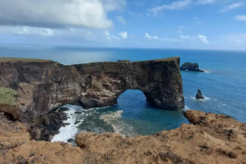
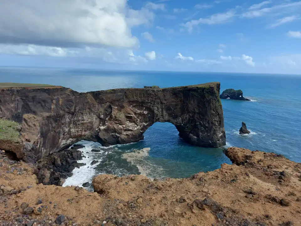
Dyrhólaey is the South Coast’s grandstand: a 120-metre promontory whose seaward side opens into a giant rock arch — wide enough, in legend, for a sailing ship — with views that fold the whole coastline into one frame: Reynisfjara’s black beach and stacks east, the Mýrdalsjökull ice cap inland, endless black-lava coast west. In summer the cliffs carry puffin colonies; year-round the lighthouse crowns the top. Trip.Best ranks it #25 (4.5/5 from verified visitors).
This is #25 of 39 in our Best Things to Do in Iceland guide. Below: the two viewpoints and what each sees, the arch story, the puffin-season rules, the photography logic (the beach’s best aerial-style frame is from here), and the Vík afternoon that pairs it with Reynisfjara (#17).
Conclusiones clave
- 120 m of promontory: the headland’s arch opens to the sea — boats pass under it in calm weather; the name means “door-hole island”.
- Two viewpoints, one gate: the lower car park (arch and puffin cliffs) and the lighthouse road (the full panorama) — both from one entrance.
- Puffins May–August: the cliffs hold one of the coast’s easiest puffin colonies — keep to the paths, they nest in the banks.
- The aerial-style shot: the whole Reynisfjara beach, stacks and Vík church — from the headland, not the beach.
- Free, seasonal gates: open access; the upper road and some paths close in nesting season and ice.
Respuesta rápida: Drive up (one entrance, two levels), shoot the arch from the lower viewpoint, walk to the lighthouse for the full-coast panorama (Reynisfjara east, the ice cap inland), and in May–August give the puffin cliffs twenty patient minutes. Then drop to Reynisfjara (#17) — the two stops are 15 minutes apart and are one composition in two acts.
The arch, the headland and the two viewpoints
Dyrhólaey (strictly Dyrhólaeyjarviti for the lighthouse end) is a former volcanic headland the sea has carved: the seaward opening — the “door hole” — forms an arch 120 metres above the surf, wide enough that hardy boat skippers run through it in calm weather (you will see the tour boats do it from above). The headland itself is grassy cliff-top: wind-real, treeless, with the lighthouse at its point and the coast curving away both directions.
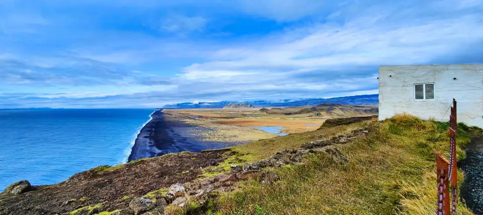
The lower viewpoint (first car park) frames the arch itself with the puffin cliffs below — the classic shot, and in summer the colony’s runway view. The upper road climbs to the lighthouse for the panorama: Reynisfjara’s black beach and the Reynisdrangar stacks east, the Mýrdalsjökull ice cap’s rim inland, the black-lava coast west toward Skógafoss. On clear days the view runs 50+ km each way — the South Coast’s single best overhead vantage.
The name: Dyrhólaey — “door-hole island” — is the arch itself; the peninsula is connected to the mainland by a narrow isthmus and technically became an island at high tide until the road causeway. The lighthouse (1927) crowns the point.
Puffin season and the cliff rules
May to August the banks below the lower viewpoint carry puffin burrows — one of the South Coast’s most accessible colonies, and the classic “puffin with the black beach behind” shot comes from exactly here. The birds surface-mill around the burrow entrances in the evenings most actively; twenty patient minutes at the marked bank usually delivers fly-bys, burrow-side perching and the beak-full-of-sand eel shot.
The rules are the colony’s future: stay on the marked paths (burrows honeycomb the banks and collapse under foot traffic), never approach the burrow entrances, keep drones grounded in nesting season, and give the colonies the evening quiet they feed on. The closures the site posts (upper road sections in nesting months) are the management that keeps the colony returning annually — respect them and the puffins keep the appointment.
The puffin window: evenings 18:00–22:00 in June–July are the most active burrow-side hours; midday the birds fish. Bring the long lens (200 mm+), stay at the path’s edge, and let the birds come to the frame — they will.
The photography logic
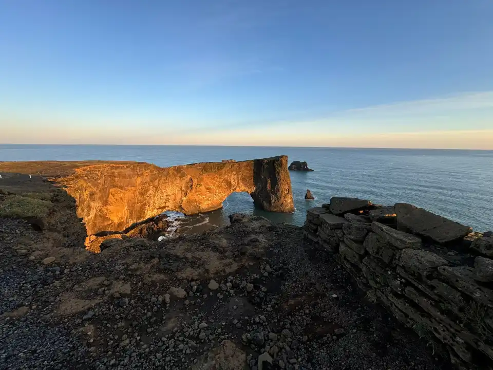
The headland’s signature is the aerial-style beach shot: from the lighthouse end, the whole Reynisfjara curve — black sand, the columns’ cliff, the stacks, Vík’s church — compresses into one composition that no beach-level angle achieves. Telephoto from the point (100–200 mm) stacks the layers; wide from the lower viewpoint frames the arch with surf. Golden hour side-lights the coast; storm days put spray through the arch itself.
Winter: the headland is the coast’s windiest classroom — hold the railings, keep the door discipline (wind opens doors; park into it), and the aurora bonus exists on clear nights with the lighthouse as foreground. Drone: national rules plus nesting-season closures — most of the year, the answer is leave it packed.
Practical: access and the pairing
Access: signed off Route 1, 15 minutes west of Vík — one entrance road climbing to the two car parks (paid). The visit: 45–60 minutes for both viewpoints; puffin evenings run longer. The upper road and bank paths close seasonally (nesting, ice); the lower viewpoint stays open year-round with the usual winter-studs discipline.
The pairing that defines the South Coast afternoon: Dyrhólaey’s panorama first (the overview), then Reynisfjara (#17) at beach level (the texture), then Vík — the Lava Show (#30) or the church hill — between. Our South Coast photography chapter sequences both stops’ light.
How it fits an Iceland route
Dyrhólaey slots between Skógafoss (#8) and Reynisfjara (#17) on the Ring Road day, or anchors the Vík overnight. The deep south continues east: Sólheimajökull (#23) west, the glacier country beyond. Our Reynisfjara guide pairs the two stops in detail, and the Ring Road guide sequences the coast.
Frequently asked questions
Can boats really sail through the Dyrhólaey arch?
Yes — the arch’s span admits boats in calm weather, and tour skippers occasionally run it; from the headland you watch the whole maneuver from 120 metres above. The name literally means “door-hole island”.
When can I see puffins at Dyrhólaey?
May to August, with evenings the most active burrow-side hours (the birds fish at sea midday). Stay on marked paths — the burrows collapse under foot traffic — and give the colonies their space.
Is Dyrhólaey or Reynisfjara better?
They are one composition in two acts: Dyrhólaey gives the aerial-style whole-beach panorama; Reynisfjara (#17) gives the beach-level texture (columns, cave, stacks). The standard South Coast day does both — 15 minutes apart.
Why do parts of Dyrhólaey close in summer?
Nesting-season management: the upper road sections and bank paths close to protect the puffin and seabird colonies. The lower viewpoint stays open — the arch and the colony’s runway view remain accessible.
Where this ranks — and what is next
Dyrhólaey is #25 of 39 in our Best Things to Do in Iceland guide — the full ranked list, built from Trip.Best traveler data, lives in one place.
Go deeper: Reynisfjara — the black beach guide (#17), Puffins in Iceland — where and when.
Sources & official references
- Trip.com listing for Dyrhólaey: 4.5/5 rating (checked November 2026).
- Trip.Best ranking data: #25 of 39 (November 2026).
- Site operator information: seasonal gates, nesting closures (checked 2026).
- Puffin colony records for the South Coast (May–August season).
- Editorial visits across seasons including puffin evenings, 2023–2026.
