









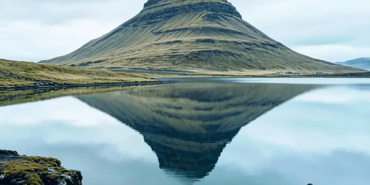
Snæfellsnes is the peninsula that answers the question every Iceland trip planner eventually asks: what if you only have one day and want to see everything? Two to two and a half hours north-west of Reykjavik, a single curl of coastline compresses the whole country into a loop drive — a glacier-capped volcano, black pebble coves, bird cliffs, lava fields and fishing villages, threaded by one scenic road. Our team has driven it in midsummer daylight, in January gales and in September fog, and this guide is the honest one-day itinerary: the stops that deserve your time, the order that beats the tour buses, and the winter caveats that decide whether the loop is a dream or a white-knuckle drive.
The nickname “Iceland in miniature” is marketing, but it is also literally true. This is the only corner of the country where you can watch seals on a beach in the morning, stand inside a volcanic crater after lunch and photograph an arrow-shaped mountain rising straight from the sea before dinner. Jules Verne picked Snæfellsjökull as the entrance to the centre of the Earth for a reason — the peninsula has always attracted storytellers, and it has a way of making travelers feel like extras in one.
Key takeaways
- One day genuinely works in summer: the full loop from Reykjavik runs roughly 10–12 hours with stops — start early and the timing falls into place.
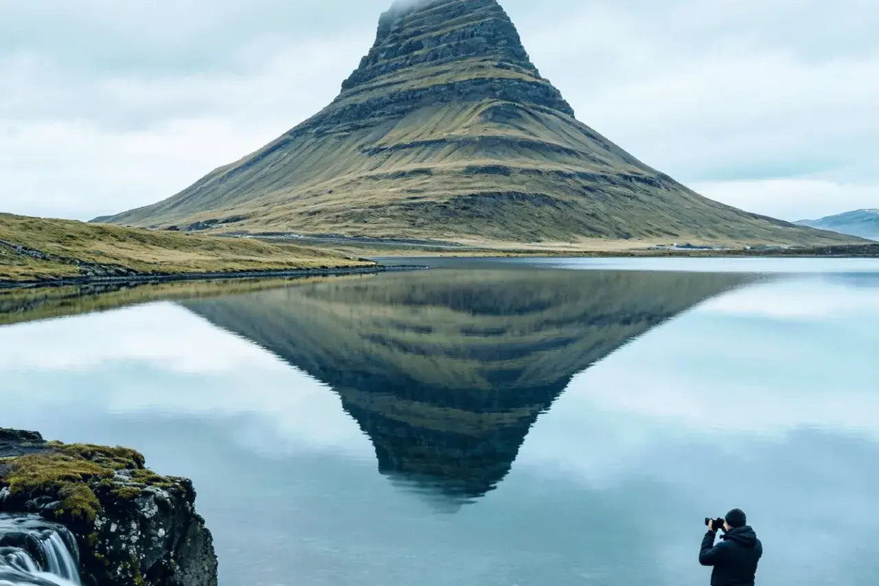
- Kirkjufell (463 m) and Kirkjufellfoss are the headline photo — best in evening light on the north shore near Grundarfjörður.
- Snæfellsjökull anchors everything: a roughly 700,000-year-old, glacier-capped stratovolcano rising 1,446 metres, protected since 2001 as Snæfellsnes National Park.
- The south shore is walking country: the Arnarstapi–Hellnar coastal path, the Gatklettur stone arch and the pebble cove of Djúpalónssandur reward a slower pace.
- Winter changes the math: short daylight and icy mountain roads turn the one-day loop into a two-day trip — or a “pick two stops” drive.
Quick answer: in summer, leave Reykjavik by 08:00 and follow the loop in order — Ytri Tunga (seals), the Arnarstapi–Hellnar walk, Djúpalónssandur, Saxhóll crater and Lóndrangar — then finish at Kirkjufell in evening light before the drive home. In winter, halve the plan: choose two or three stops on ploughed main roads, check road.is and the forecast the night before, and be back off the peninsula by dusk.
Why they call it Iceland in miniature
Most Icelandic regions specialize. The south coast does waterfalls and black sand, the north does geothermal valleys and whale bays, the highlands do rhyolite and river crossings. Snæfellsnes refuses to specialize. Within a single loop of well-signed roads you pass a glacier-topped volcano, mossy lava fields, a golden seal beach, sheer basalt cliffs, pebble coves littered with shipwreck iron, and villages where the harbour is one lane wide and the fish comes off the boat directly onto your plate. It is the island’s whole argument in about 180 kilometres of coastline.
The peninsula sits roughly 180 km from Reykjavik to its western tip — about two to two and a half hours of driving before you even begin the sightseeing. That proximity is exactly why the one-day itinerary works when it fails almost everywhere else in the country: nothing on the loop is more than twenty minutes from the next stop, and the scenery does the waiting for you. Snæfellsjökull, the glacier-capped volcano on every horizon, was the gateway Jules Verne chose for “Journey to the Centre of the Earth” — and legends of trolls and guardian spirits ride along with you, which is easy to understand out here.
The one-day loop: order and timing
The classic day runs counterclockwise: Reykjavik up Route 54 along the peninsula’s south side, westward past the seal beach at Ytri Tunga, through Arnarstapi and Hellnar, out to Djúpalónssandur, back east to Saxhóll and Lóndrangar, then across to the north shore for Kirkjufell before returning over the mountains or along the coast. In the long light of June and July this fills a day comfortably — ten to twelve hours door to door — without ever feeling rushed.
- Start before the buses. Day tours converge on Arnarstapi and Kirkjufell in the early afternoon; if you reach the south shore by 10:00 you will have the coastal walk largely to yourself.
- Fuel up before you leave the main road. Petrol stations thin out fast west of Borgarnes and around the peninsula’s tip — fill the tank and grab provisions in advance.
- Build a weather slack. The peninsula catches Atlantic weather head-on. If wind closes a beach stop, swap the order rather than cancel the day.
- Watch single-lane bridges on the coastal sections — the yield rule is simple (the second car waits), but drive like everyone has forgotten it.
Worth knowing: there is no need for a 4×4 on the classic loop — every stop on this itinerary sits on paved roads. The exceptions are some side tracks and highland-adjacent routes in the peninsula’s interior; if your plan drifts off the coastal road, check road.is for conditions and your rental contract for what is allowed.
The south shore: seals, arches and the Arnarstapi–Hellnar walk
Start the sightseeing at Ytri Tunga, a golden farm beach where harbour seals haul out on the skerries through the summer months. Bring the zoom lens: the seals rest on the rocks just offshore and barely tolerate photography, let alone people. It is a fifteen-minute stop that reliably becomes forty.
Then continue west to Arnarstapi, the fishing village under the lava cliffs, and walk the coastal path toward Hellnar. The route is an easy hour or so each way over clifftop grass and lava, past the Gatklettur stone arch — a natural bridge of layered basalt polished by the surf — and past the monumental sculpture of Bárður Snæfellsás, the peninsula’s legendary guardian, half human and half troll, whose spirit the old stories place inside the glacier itself. Hellnar has a small café with a terrace over the water; on a calm day it is the best lunch seat on the peninsula.
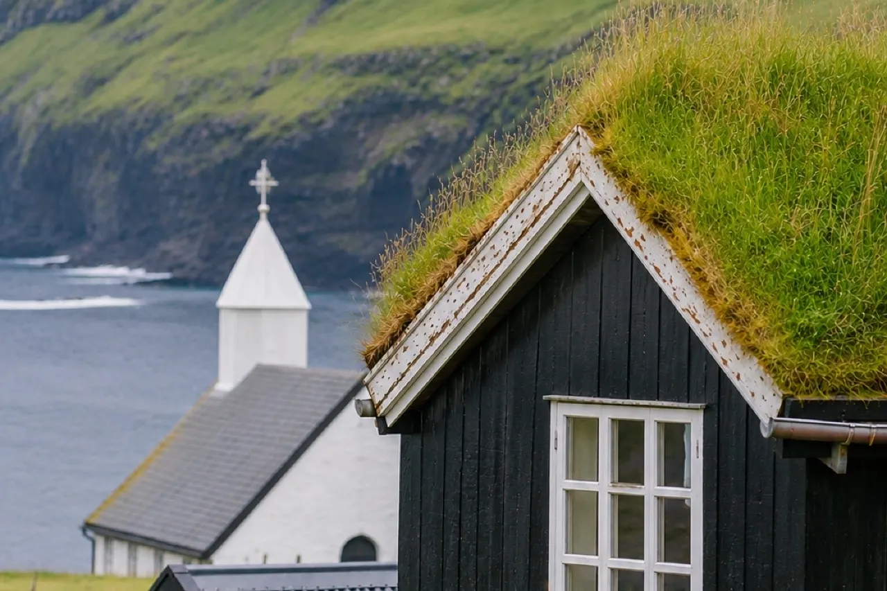
Back on the road, detour to Búðir, where the black timber Búðakirkja stands alone in a lava field with nothing but dunes and the sea for company. It is one of the most photographed buildings in Iceland precisely because it is so deliberately isolated — and yes, summer weddings book it months ahead.
Djúpalónssandur and the lifting stones
The road to Djúpalónssandur runs through a lava field that feels like driving into a rummage of giants. At the end, a path threads between rock walls to a black-pebble cove where the Atlantic detonates against the shore. The pebbles are smooth, uniform and protected — lifting them off the beach is forbidden, and honestly pointless, because the cove’s real objects are on display above the tideline: rusted ribs, a winch and boiler plating from the British trawler Epine (GY7), wrecked here in 1948 with heavy loss of life. The wreck is a memorial, not a photo prop, and most visitors go quiet when they reach it.
On the flat above the cove sit four lifting stones, once used to test the strength of fishermen competing for crew places on the rowing boats. The heaviest, Fullsterkur (“fully strong”), weighs 154 kg; the others step down from there, and the tradition held that a man who could not lift a given stone was not worth the wages. Try the lighter ones if you must — our team’s record is embarrassing and will not be published — and then walk the cliff path to the cove’s neighbour, Dritvík, where the fishing station rows once numbered in the hundreds.
From real trips: Djúpalónssandur in fog is a different place — muffled, iron-grey, the surf the loudest thing on earth. Do not wish the fog away: the same path becomes the best atmosphere on the peninsula, and it costs nothing but a windproof shell.
Saxhóll, Lóndrangar and the lava caves
East of Djúpalónssandur the road climbs past Saxhóll, a scoria crater 109 metres high with a metal stairway spiraling to the rim. The climb takes ten unhurried minutes and delivers the best 360-degree panorama on the peninsula: lava fields to every horizon, the glacier behind you, the sea stacks of Lóndrangar rising ahead like a cathedral’s broken towers. On a clear day you can trace the whole day’s route from the top.
Lóndrangar itself, the basalt plugs visible from the stairway, has a short viewpoint path below — sea birds wheel the columns in summer, and in rough weather the spray is visible from the road. Nearby, Vatnshellir offers the peninsula’s underground itinerary: a lava tube explored on guided tours only, helmets and headlamps provided, descents into chambers where the ropy lava ceilings are still glassy. It is an easy, family-friendly cave by Icelandic standards, and a good rain-plan slot because the weather, famously, does not exist forty metres underground.
- Saxhóll: short stairway, big reward; the windiest spot on the loop — hold hats and drones with care.
- Lóndrangar: viewpoint stop; nesting birds in summer mean the columns themselves are off-limits to climbers.
- Vatnshellir: guided tours only — book ahead in July–August and wear closed boots.
Kirkjufell and the north shore
Every Snæfellsnes day ends the same way, and the ending is engineered: Kirkjufell, the 463-metre arrowhead beside Grundarfjörður, with the three-stepped Kirkjufellfoss in the foreground. The classic composition is ten steps from the car park, and in the long evening light of midsummer the mountain turns amber while the falls catch the last direct sun. In aurora season Kirkjufell is one of the country’s most popular northern-lights foregrounds, which explains the tripod-wielding September crowds.
Should you climb the mountain itself? The famous view is from the waterfall, and that is where our team stops. The peak route is a steep, exposed scramble that has earned the mountain a reputation for rescues; treat the summit as a mountaineering decision, not a walk, and let the waterfall platform deliver the photograph. Across the bay, Grundarfjörður makes a sensible dinner stop before the return leg — the village is small, practical and unbothered by its postcard fame.
Seasons: the summer loop vs the winter drive
Summer (June–August) is the one-day itinerary’s home turf: near-continuous daylight means an 08:00 start is civilized rather than heroic, the seals are hauled out at Ytri Tunga, the cave and crater walks are dry underfoot, and the evening Kirkjufell shot runs so late it barely counts as night. Crowds concentrate at Arnarstapi and Kirkjufell midday; the order above is designed to put you at those stops early and late respectively.
Shoulder months (May, September) trade some comfort for atmosphere — fewer buses, migrating birds, and the season’s first reliable aurora windows on clear nights. Winter (November–March) rewrites the plan: daylight shrinks to a handful of hours, the mountain roads between the peninsula’s two coasts ice up regularly, and wind events close sections without much warning. The honest winter itinerary is half a loop — pick Kirkjufell or the south-shore villages, not both — with road.is and the en.vedur.is forecast consulted the night before and again at breakfast. The reward for the reduced ambition is real: aurora over Kirkjufell, or Snæfellsjökull glowing pink above a frozen coast, is a winter image few travelers ever collect.
Frequently asked questions
Can you really do Snæfellsnes in one day?
In summer, yes — it is the single best one-day loop in Iceland, roughly 10–12 hours from Reykjavik including stops. In winter, no: split the peninsula over two days or choose one shore. The deciding factors are daylight and road conditions, not distance.
Do I need a 4×4 for the peninsula?
Not for any stop in this guide — the full loop runs on paved roads. A 4×4 only becomes relevant for interior tracks and off-season conditions, and even then F-road and rental-contract rules apply. Check road.is when planning.
Where and when can I see the seals at Ytri Tunga?
Summer is the reliable season, when harbour seals rest on the skerries just off the golden beach. Keep to the shore, use a zoom lens and never approach or disturb hauled-out seals — they are wild animals, not attractions.
Is the Vatnshellir lava cave suitable for children?
Generally yes — it is a guided, helmeted walk through a spacious lava tube rather than a crawl. Tours run on fixed schedules in the main season, so book ahead, and bring warm layers because the cave holds a constant chill regardless of the weather above.
What if the weather turns mid-loop?
Reorder, do not abandon. The stops are interchangeable blocks: if wind makes the west-end beaches unpleasant, swap in the lava cave, Saxhóll or a Grundarfjörður lunch and let the coast wait. If conditions turn genuinely dangerous, the day ends — Iceland’s rule of thumb beats any itinerary.
Fit the peninsula into the bigger trip
Snæfellsnes slots neatly before or after a Golden Circle day — our route guides show exactly where the loop belongs in your itinerary.
Before you drive west, skim our Golden Circle guide if the geysers are still on your list, pack for the peninsula’s weather with the all-season packing guide, and read the weather & wind planning guide before trusting any forecast. If you are basing in the capital, the Reykjavik neighborhood guide will put you on the right side of town for an early start north.
Sources & official references
- Official Icelandic services: road.is (road conditions and closures), en.vedur.is (weather and aurora forecasts), safetravel.is (coastal and outdoor safety) — checked 2026.
- Snæfellsnes National Park visitor information (park designation 2001, Snæfellsjökull geology) as published by the Icelandic Environment Agency.
- Trip.com Iceland destination guide (checked 2026): peninsula drive times, Kirkjufell and Djúpalónssandur listings, and one-day itinerary framing.
- Local heritage sources for the lifting-stone tradition, the Epine (GY7) wreck of 1948 and the Bárður Snæfellsás legend.
- Editorial visits across seasons 2024–2026 by the Iceland Travel Guides team.
