



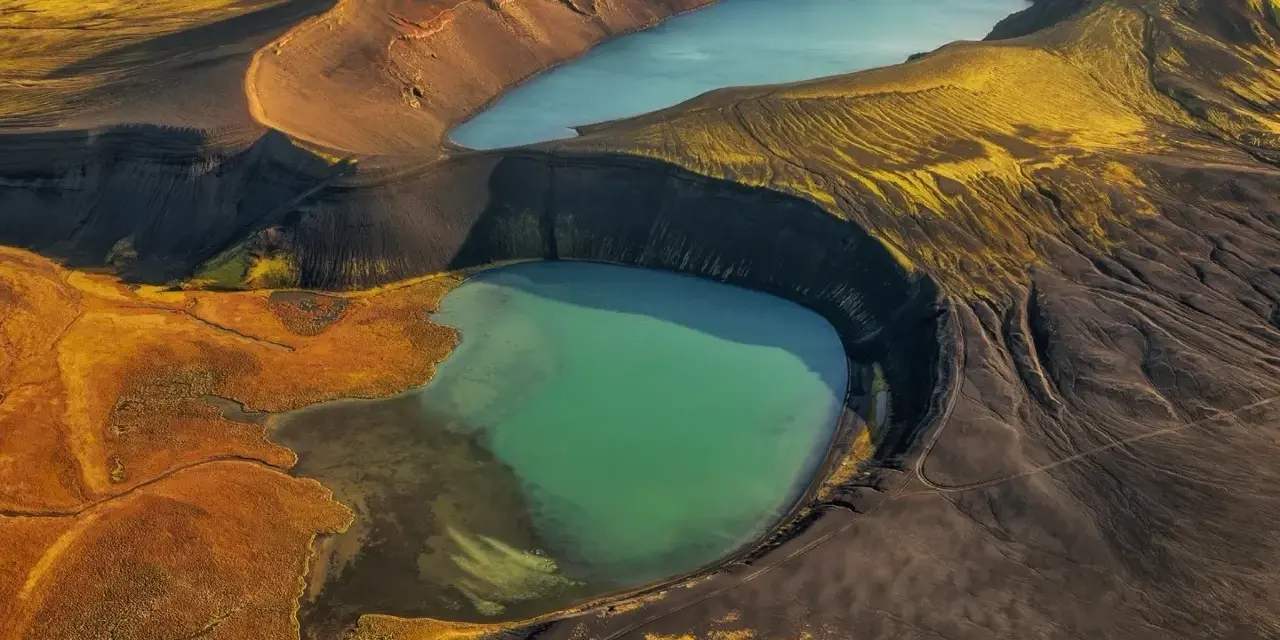
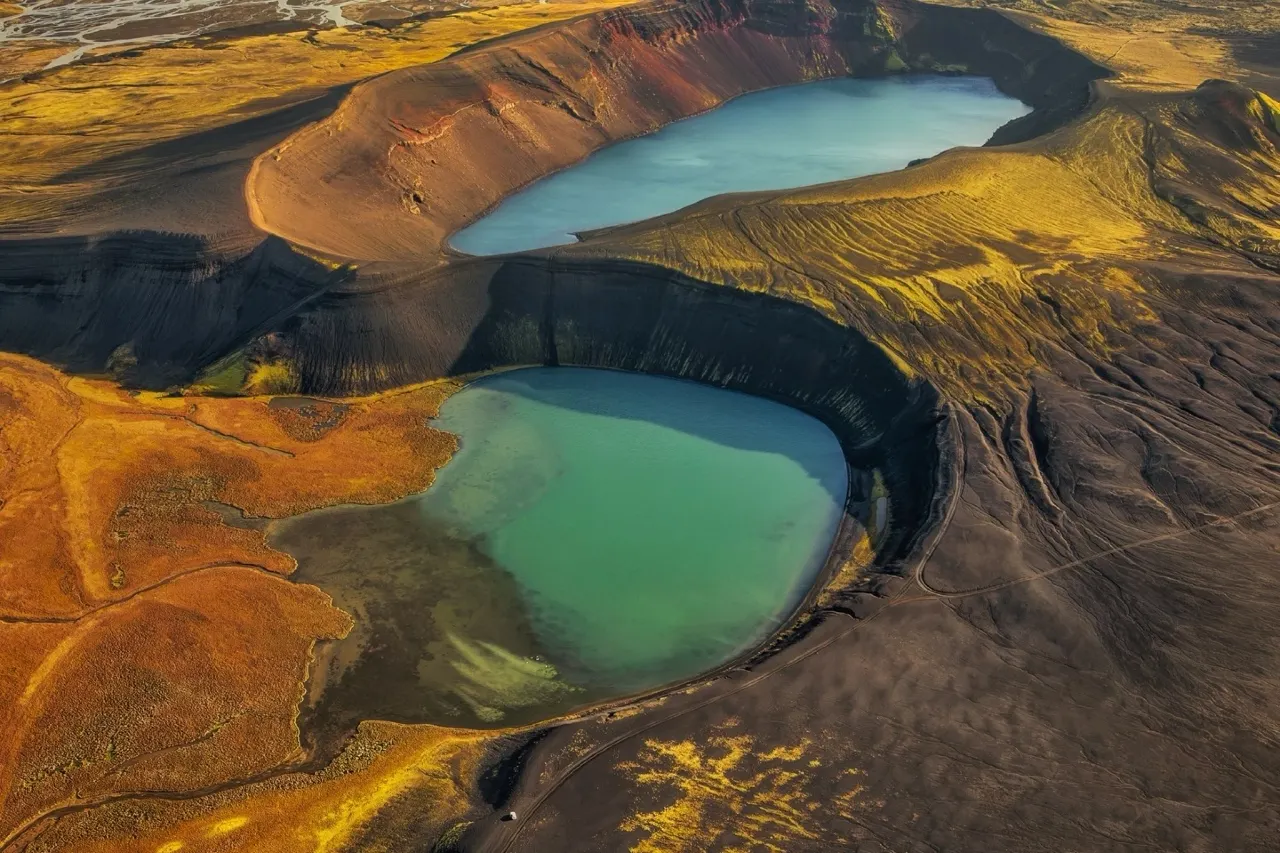
Most of Iceland’s famous sights announce themselves from the road — a plume of steam, a white ribbon of water, a black headland. Kerið does the opposite. This perfect red bowl sits quietly in the Grímsnes countryside near Selfoss, and if you blinked while driving past you would never know that a 55-metre-deep crater with its own milky-turquoise lake lies just over the fence. Our team considers it the Golden Circle’s best-value detour: a small entrance fee, a 30–40 minute rim walk, and geological drama you can stand inside rather than observe from a distance.
It is also the ideal gateway to a bigger subject. Iceland is essentially a crater farm — scoria cones, tuff rings, flooded calderas — and once you understand what Kerið is, half the country’s landscape starts making sense. This guide covers the crater itself, how to fit it into a Golden Circle day, the honest photography notes, and the other craters worth adding to a ring-road itinerary if the volcanic logic hooks you the way it hooked us.
Temel çıkarımlar
- Geologically young: Kerið is roughly three millennia old by the most widely cited estimate, though some tour listings quote older figures — the honest answer is “about 3,000 years, possibly more”.
- The numbers: about 55 metres deep from rim to water and roughly 170–270 metres wide — small enough to walk the full rim in half an hour, big enough to feel like a proper crater.
- The lake has no river inflow: it is fed by groundwater, so its surface level quietly tracks the water table rather than any stream.
- Access is simple: a small entry fee paid at a self-service kiosk, parking by the crater, and a rim path that loops in around 30–40 minutes.
- Golden Circle country: it sits near Selfoss and Grímsnes, an easy add-on to Þingvellir, Geysir and Gullfoss — and it is one of the few such stops you can experience in under an hour.
Hızlı cevap: treat Kerið as a 30–60 minute stop. Pay the small fee at the kiosk, walk the complete rim loop, look down at the lake, and go either early or late in the day — the red slopes photograph best in warm side light, and the tour-bus crowds cluster around midday. Pair it with a Golden Circle run and you have a full, varied day without much driving.
How Kerið formed: crater geology 101
Volcanic craters come in two broad flavors, and the difference is water. When rising magma meets groundwater or wet sediments, the flash-boiled steam blows the ground apart in a series of explosions, building a wide, low ring of shattered rock — a phreatomagmatic tuff ring. When gas-rich magma simply fountains into the sky instead, it piles up a taller, narrower cone of scoria and spatter. Iceland has textbook examples of both: Hverfjall near Mývatn is a tuff ring about a kilometre across, while Kerið belongs to the scoria-cone family.
Kerið’s red walls are oxidized iron in the volcanic rock — the same chemistry that rusts a hinge, scaled up to geological size. The lake at the bottom is not a pond left over from the eruption: it has no spring or river inflow and simply sits where the groundwater table pokes above the crater floor. That is why its level and hue shift quietly over time, and why on a still day the water reads an improbable opaque turquoise against the red slopes. The contrast is the whole show, and it is entirely natural.
Worth knowing: the crater is a protected site and the slopes are soft, crumbling scoria. Stay on the marked paths — both on the rim and on the steeper spur that drops partway toward the shore. The rocks shed surprisingly easily, and a sliding descent does the site no favors.
Visiting today: parking, fees & the rim path
Kerið is refreshingly uncomplicated. You park beside the crater, pay a small fee at the self-service kiosk (card-friendly), and walk up to the rim. The full loop takes most people 30–40 minutes at a photo-friendly pace, and it is genuinely worth completing — each side of the bowl frames the lake differently, and the far side drops you out of the wind, which matters more than you would expect in the Grímsnes open country.
- The rim loop: a well-trodden path with a few short climbs; sturdy shoes are enough in dry weather, traction helps when it is icy.
- Toward the shore: a steeper path descends partway down the inner slope toward the lake — beautiful in calm conditions, slippery in rain, and best skipped with small children or a strong wind.
- Tesisler: think of it as a nature stop, not a service stop — toilets and cafés live in Selfoss or along the Golden Circle route, not here.
- Time budget: 30 minutes minimum, 60 if you walk the full rim and sit for a while. It slots into any itinerary.
One curiosity for the trivia night: in 1987, the Icelandic singer Björk performed on a floating raft out on the lake. It remains the most memorable thing to happen on Kerið’s water since the groundwater found it — and it says something about how central this crater is to Iceland’s sense of itself.
Fitting Kerið into the Golden Circle
Strictly speaking, the classic Golden Circle route runs Þingvellir–Geysir–Gullfoss; Kerið sits just south of that triangle near Selfoss, close enough that almost everyone folds it in. Our preferred order for a one-day loop: start at Þingvellir early, cross to Haukadalur for the geysers before the biggest crowds, continue to Gullfoss, then finish at Kerið in late afternoon — the slopes warm up in the low sun and the crowds have thinned. Reversing the order works too; the crater is the most flexible stop of the four because it needs no timing luck.
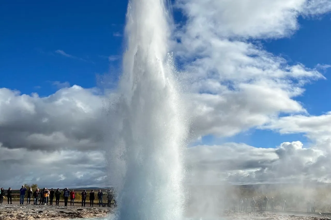
The pairing logic is real geology, not just itinerary convenience: on one day you see the tectonic rift at Þingvellir, the live geothermal plumbing of Haukadalur, a glacial river’s masterwork at Gullfoss, and a finished volcanic product at Kerið. Four different processes, four different landscapes, one loop. That is the Golden Circle’s quiet argument for itself, and Kerið is the chapter most people skip.
Iceland’s other great craters
If Kerið whets the appetite, the country offers deeper cuts — and visiting a few of them is the best way to internalize the two crater families described above.
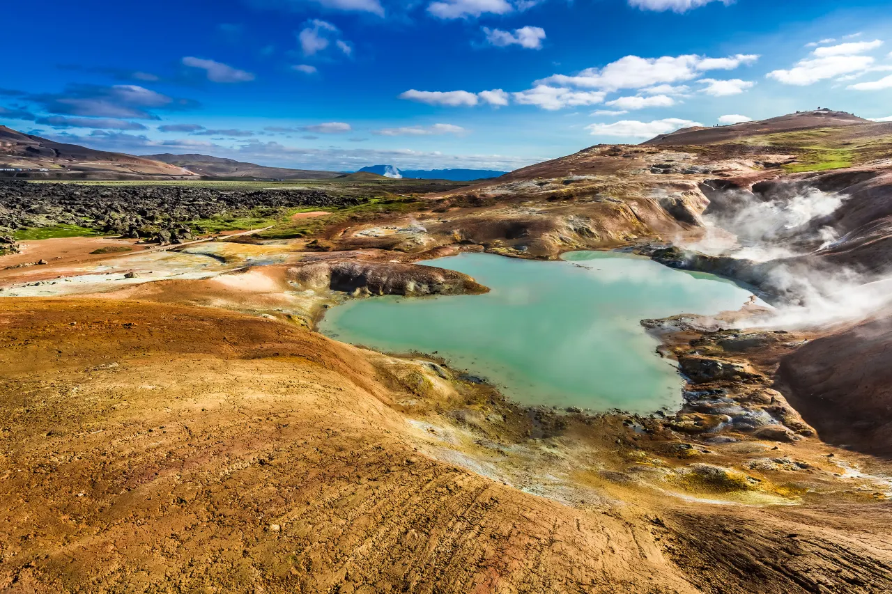
- Hverfjall (Mývatn): a near-perfect tuff ring about a kilometre wide with a walk-up path onto the rim — the phreatomagmatic counterpart to Kerið’s scoria cone, in the country’s best geothermal neighborhood.
- Víti (Krafla and Askja): two different crater lakes with the same name (“hell”), both born of violent eruptions; the Krafla one pairs naturally with the geothermal fields nearby, and Askja’s sits deep in the highlands.
- Ljótipollur: a red-walled crater lake in the southern highlands — the name translates as “ugly puddle”, which is the most generous self-description in Icelandic geography.
- Saxhóll and Eldborg: two of the west’s classic cones, both reachable as short climbs and both proof that a crater does not need a lake to impress.
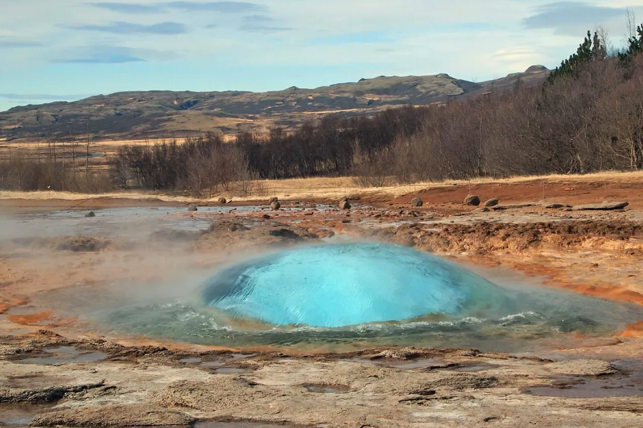
The north holds the richest concentration: our Mývatn geothermal guide covers Hverfjall, Víti and the steaming fields around them in detail, while the west’s cones are laid out in our Snæfellsnes itinerary. Between those two trips and a Golden Circle day, you will have seen every major crater type the island produces.
Light, color & photography notes
Kerið rewards direction of light more than quality of light. The red slopes are richest in low, warm side-light — late afternoon through the western arc of the rim, or early morning from the opposite side. Flat overcast flatters the lake’s turquoise and mutes the reds; midday sun flattens everything. If you can only shoot one moment, make it the last hour before sunset with the lake behind the crater’s far wall.
Drones are permitted under the national rules — maximum 120 metres altitude, always within line of sight, and at least 150 metres from public buildings — but check for any seasonal site restrictions on arrival, and give walkers on the rim plenty of room. In autumn the birch scrub around the crater turns rust-orange and the whole bowl looks like it was color-graded on purpose; in winter the rim path carries ice, the lake sits sullen under snow-dusted slopes, and traction devices earn their place in the bag.
When to go
Yaz: the easy season — long light, green surroundings, and the widest choice of tour combinations. The trade-off is midday congestion as Golden Circle tours cycle through; go before ten or after five and you will often have the rim nearly to yourself. Kış: shorter days and an icy rim, but the crater keeps its drama and the low sun does interesting things to the red rock all day long. Shoulders: our pick — May and September give you the color without the conveyor belt, and the weather usually allows the full rim walk in comfort.
Frequently asked questions
Can you swim in the lake at Kerið?
No — the visit is about the rim and the view. The lake is cold, groundwater-fed, and the inner slope is steep and crumbling; there are no swimming facilities or lifelines of any kind. For a proper soak, the lagoons and pools covered in our hot-springs guides are the right tools.
How much does it cost to enter Kerið?
A small entry fee, paid at the self-service kiosk by the parking area — no booking, no ticket office. Think of it as a nature-site contribution rather than an attraction ticket; the fee supports path maintenance at a site that gets heavy seasonal traffic.
How long should I spend at Kerið?
Half an hour minimum for the rim’s best viewpoints, and around an hour if you complete the full loop and walk partway toward the shore. It is the rare Icelandic headline sight that fits cleanly inside a coffee-stop window.
Is Kerið officially part of the Golden Circle?
The classic route is defined as Þingvellir, Geysir and Gullfoss; Kerið sits just south near Selfoss and Grímsnes. In practice almost every self-drive itinerary and many tours add it — it is the Golden Circle’s most common unofficial fourth stop.
Which other craters are worth a detour?
Hverfjall and Víti at Krafla in the north, Ljótipollur in the southern highlands, and Saxhóll and Eldborg in the west are the reliable standouts. Match them to your route rather than chasing all of them — the north pair alone, with the Mývatn geothermal fields, justifies a full day.
Build the full Golden Circle day
Our Golden Circle guide sequences Þingvellir, Geysir and Gullfoss — with Kerið as the quiet finisher.
Keep the volcano theme running: Gullfoss shows what meltwater does to rock (Gullfoss guide), Þingvellir shows the plates pulling apart (Þingvellir guide), and if you are linking several regions together, the Ring Road planning guide is where the crater detours slot into a longer route.
Sources & official references
- Official Icelandic services: road.is (winter road status around Selfoss and Grímsnes), en.vedur.is (weather and wind forecasts for the rim walk) — checked 2026.
- Trip.com Iceland destination guide and tour listings (checked 2026): Kerið profile, seasonal access notes and tour-quoted age estimates that vary from the widely cited ~3,000 years.
- Icelandic geology background: published literature on the Grímsnes volcanic system, scoria cones and phreatomagmatic tuff rings; crater dimensions as commonly published (55 m depth, ~170–270 m width).
- Site visitor information: self-service entry kiosk and rim path guidance as posted on site, 2025–2026.
- Editorial visits by the Iceland Travel Guides team across seasons, most recently 2025–2026.
