

Þingvellir is the only place where you can walk a national history and a geological process in the same hour. The rift valley — the visible seam where the North American and Eurasian plates pull apart at ~2 cm a year — is also the parliament plain where the Alþingi met from 930 AD, making it the site of the world’s oldest surviving legislature. UNESCO-listed for both reasons, free to enter, 45 minutes from the capital: it is the Golden Circle’s brain and Iceland’s origin story in one valley.
This is #18 of 39 in our Best Things to Do in Iceland guide (4.9/5 from 124 verified reviews — among the list’s very highest). Below: the Almannagjá fault walk, Öxarárfoss, the Silfra snorkel (the clearest water you will ever see), the autumn aurora bonus, and the visitor logistics that make the park work in every season.
Principais conclusões
- Two plates, one valley: the mid-Atlantic ridge surfaces here — the Almannagjá fault wall is the North American plate’s edge, walkable.
- Parliament since 930 AD: the Alþingi met on the plain for ~900 years; the Law Rock, where laws were recited, anchors the site’s history.
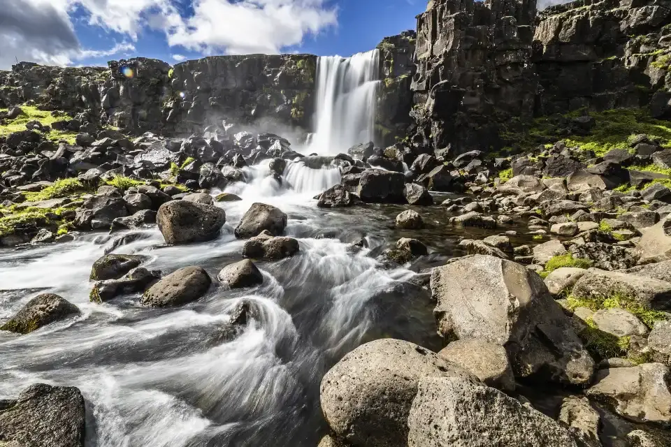
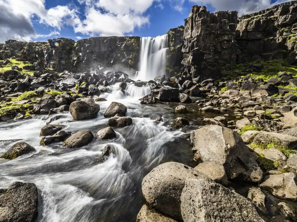
- Öxarárfoss: the waterfall that drops into the rift itself — the man-routed river’s 20-metre fall into the fault.
- Silfra: the clearest dive: the fissure between the plates with 100-metre visibility — snorkel/dive experiences run year-round, guided only.
- Aurora and autumn colour: clear September–March nights put the lights over the rift walls — the Circle’s best aurora frame.
Resposta rápida: Walk the Almannagjá fault path from the visitor centre (the plates close over your head), see the Law Rock and the Alþingi plain, continue to Öxarárfoss, and book Silfra if snorkelling is your thing. Autumn: the birch colour plus first aurora make September–October the park’s best months. Winter: plowed paths, studs, and the aurora option.
The Almannagjá walk and the parliament plain
The signature walk drops you into geology: from the visitor centre, the path descends into Almannagjá — the fault gorge between the plates — and walks its floor with the North American wall rising on one side and the European plate’s slope on the other. The scale is subtle and then enormous: what reads as a grassy valley from the rim is a visible piece of mid-ocean ridge, and the interpretive markers measure your walk in plate-tectonics as well as metres.
The parliament layer sits on top: the Law Rock (Lögberg) where the lawspeaker recited the laws annually, the Alþingi’s booth-plain where the chieftains’ camps stood, the gallows site (Drekkingarhylur, the drowning pool — the darker history), and the church with its turf-adjacent graveyard. The national story is heavy here: this is where Iceland declared itself (930), where it accepted Christianity (999/1000), and where independence-era crowds gathered (1930, 1944). The visitor centre exhibition tells it properly; the plain tells it silently.
Why the river looks man-made: Öxará was re-routed in medieval times to supply the assembly with water and drinking ice — the river runs a channel cut into the fault, and its waterfall (Öxarárfoss) drops 20 metres into the rift where the channel meets it.
Silfra: the clearest water on Earth
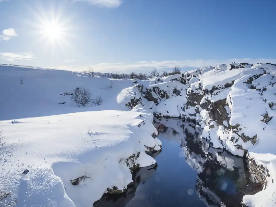
Silfra is the spring-fed fissure between the plates where glacial meltwater — filtered through porous lava for 30–100 years — enters at 2°C with visibility beyond 100 metres: the clearest water regularly swimmable anywhere. Guided snorkel and dive tours run year-round from the Silfra entry (dry-suit snorkelling is the standard; diving needs certification). The experience is the plates themselves: you float in the crack between continents, touching both walls at the widest points.
Booking: tours run on fixed slots year-round (winter included — the 2°C water is irrelevant in a dry suit, and the winter light into the fissure is exceptional). It is the Golden Circle’s premium add-on and one of Iceland’s signature experiences — book ahead in summer, walk-up chances exist in winter. Not a swimmer? The viewing platforms at the entry show the blue.
The winter aurora frame: Þingvellir is the Golden Circle’s dark-sky site — on clear nights the rift walls silhouette under the lights, 40 minutes from the capital’s glow. The photography guide’s aurora chapter ranks it top-three nationally for composition-plus-access.
Practical: access, seasons and paths
Access: Route 36 from the capital (45 min), two car parks (paid) at Hakið (main visitor centre, north) and the south lot. The park is open 24/7 year-round; the visitor centre and café run daily (reduced winter). The standard circuit — fault walk, Law Rock, Öxarárfoss, lake overlook — takes 1.5–2 hours; Silfra adds its slot time.
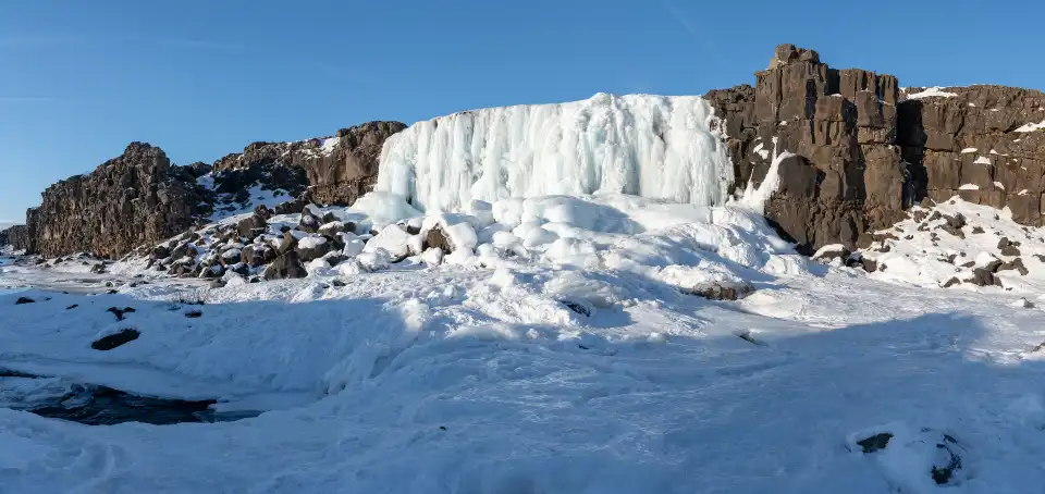
Seasons: summer brings every path, the full green valley and the midnight sun; September–October add birch colour and the returning aurora (the park’s sweet spot); winter keeps the main paths plowed (studded overshoes recommended; the rim paths close when iced) and compresses daylight. The lake (Þingvallavatn) frames every season — the parks’ largest natural lake, the subject of the overlook.
How it fits an Iceland route
Þingvellir is the Golden Circle’s first or last stop (#11 — the order logic is in that post): Geysir (#14) and Gullfoss (#13) complete the classic trio, Kerið (#16) sits on the return. The park also connects west to Reykjavík’s day-trip network and north toward Borgarfjörður (Hraunfossar #38). Our Þingvellir deep-dive carries the parliament history in full, the photography guide’s chapter covers the rift frames, and the Silfra experience deserves its own half-day.
Frequently asked questions
Can you touch two continents at Þingvellir?
Yes — Silfra, the spring-fed fissure, lets you float between the plates on guided snorkel or dive tours; the Almannagjá walk puts you between the plate walls on foot. The plates separate ~2 cm a year.
Why is Þingvellir historically important?
The Alþingi — founded ~930 AD — met here for centuries, making it the world’s oldest surviving parliament site; the Law Rock, the Christianisation of 999/1000 and the independence gatherings all happened on this plain. UNESCO lists it for culture and geology together.
Is Þingvellir good for aurora?
Excellent — it is the Golden Circle’s dark-sky site, 40 minutes from the capital, with north-facing rift-wall compositions. Clear September–March nights work; the en.vedur.is cloud map decides.
How long do you need at Þingvellir?
1.5–2 hours covers the fault walk, Law Rock and Öxarárfoss; half a day adds Silfra or the lake shore. It is a flexible stop — scale it to the day you have.
Where this ranks — and what is next
Thingvellir National Park is #18 of 39 in our Best Things to Do in Iceland guide — the full ranked list, built from Trip.Best traveler data, lives in one place.
Go deeper: Þingvellir — the historic and geological wonder (full guide), The Golden Circle route logic (#11).
Sources & official references
- Trip.com listing for Thingvellir National Park: 4.9/5 rating, 124 reviews (checked November 2026).
- Trip.Best ranking data: #18 of 39 (November 2026).
- Þingvellir National Park official information: paths, parking, Silfra rules (checked 2026).
- UNESCO World Heritage listing records (2004).
- Editorial visits across seasons including aurora sessions, 2023–2026.
