







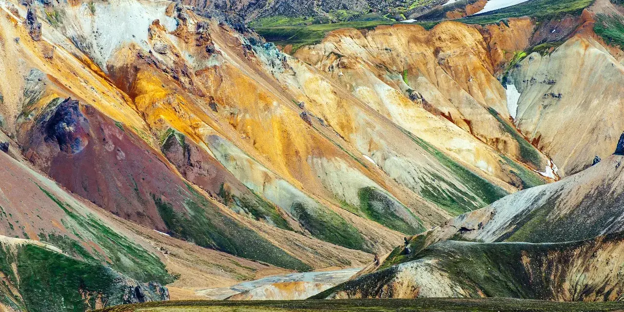
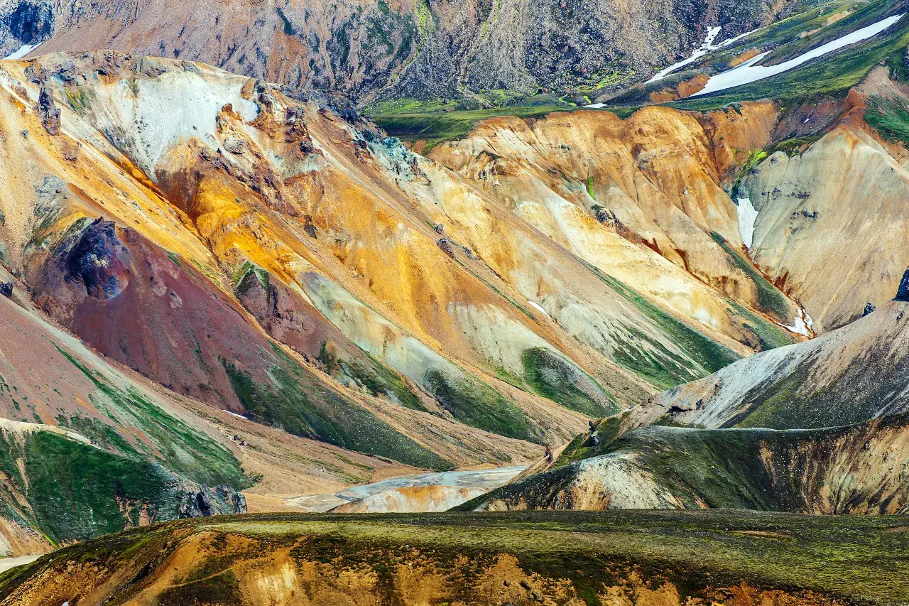
Há um momento na F208, cerca de meia hora antes de Landmannalaugar, em que a Islândia verde que você dirige desaparece completamente. As colinas ficam laranja, ferrugem, mostarda e amarelo-enxofre; o vapor sobe das encostas como se o solo respirasse; e a estrada se estreita em uma faixa de cascalho vulcânico que atravessa rios de areia preta e vítrea. Esta é a Reserva Natural de Fjallabak, e no seu coração fica Landmannalaugar - as montanhas arco-íris riolíticas, um campo de lava de obsidiana negra e um rio geotérmico quente o suficiente para se banhar, tudo isso gratuitamente no início da trilha. Nossa equipe caminhou aqui em todos os estados climáticos que as terras altas oferecem; este guia é tudo o que gostaríamos que alguém tivesse nos contado pela primeira vez - como entrar, quais caminhadas valem a pena, como funciona o rio quente e as regras de segurança que não são negociáveis.
Landmannalaugar é também o início da trilha ao norte de Laugavegur, a caminhada mais famosa da Islândia, e a capital das caminhadas diurnas nas terras altas do sul. Quer você tenha três horas ou quatro dias, a aritmética é a mesma: um verão curto, estradas que abrem tarde e fecham cedo, nenhuma loja por perto e um clima que pode transformar um cartão postal em um exercício de sobrevivência antes do almoço. Feito corretamente, é o melhor dia – ou quatro dias – fora do anel viário.
Principais conclusões
- A cor é geologia: Landmannalaugar fica na Reserva Natural de Fjallabak, onde colinas de riolito arco-íris encontram a lava negra de obsidiana de Laugahraun, que entrou em erupção em 1477.
- O rio quente é gratuito: a água geotérmica aquece uma piscina na beira do vale – sem ingresso, apenas as regras padrão da Islândia: lavar antes de mergulhar.
- O acesso é sazonal: Os ônibus das terras altas circulam no verão de Reykjavik via Hella, ou você dirige o F208/F225 em um 4×4 adequado – as estradas abrem aproximadamente do final de junho ao início de outubro, dependendo do clima.
- A caminhada clássica de um dia é o circuito Laugahraun – Brennisteinsalda, cerca de 4 km em 2–3 horas, através de lava, saídas de vapor e as coloridas encostas de “ondas de enxofre”.
- Traga tudo: não há lojas nem serviços - alimentação, camadas e um plano verificado em relação à previsão são de sua responsabilidade.
Resposta rápida: para uma viagem de um dia, pegue o ônibus de verão nas montanhas de Reykjavik, caminhe pelo circuito Laugahraun – Brennisteinsalda (cerca de 4 km, 2–3 horas), adicione Bláhnúkur se as pernas e o tempo permitirem e termine com um banho de rio quente antes do último ônibus sair. Para uma experiência completa, caminhe pelo Laugavegur até Þórsmörk – cerca de 55 km em quatro dias.
Por que as terras altas parecem outro planeta
The Icelandic highlands are the interior above the inhabited fringe: desert, lava and mountains where trees gave up long before humans arrived. Fjallabak (“behind the mountains”) is protected precisely because its ground is fragile: volcanic soils that hold their shape for centuries and their footprints for decades. Landmannalaugar is the reserve’s gateway, and its palette comes from rhyolite, a volcanic rock whose minerals stain the hillsides in bands of red, orange, ochre, green and blue-grey.
The landscape is young and active. The Laugahraun lava field, which the loop trail crosses, flowed from the eruption of 1477 — within written Icelandic history — and its surface is black obsidian rubble that clicks underfoot like broken bottles. Steam vents thread the slopes at Brennisteinsalda, Frostastaðavatn’s lake glitters blue among the hills, and the whole valley smells faintly of sulphur. It is a landscape that photographs like science fiction and hikes like nowhere else in Europe — and it stays that way only because everyone who visits treats it as the fragile thing it is.
Worth knowing: the name means “the Landmann’s hot springs” — the bathing tradition is centuries old. The river’s warm water comes from the same geothermal system that steams the hillsides; the pool sits where the hot and cold currents mix at the lava field’s edge.
Como chegar: ônibus, 4×4 e regras de trânsito F
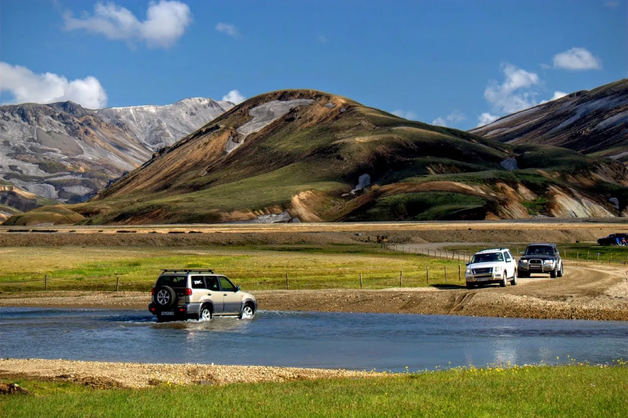
Three ways in, each with different arithmetic. Highland buses run in summer from Reykjavik via Hella and the Landmannahellir route — no rental risk, a driver who knows the rivers, and a timetable that imposes a sane day length. Self-driving means the F208 or the F225 approach, mountain F-roads that require a genuine 4×4 with appropriate clearance. Guided 4×4 tours split the difference for travelers who want the drive without the responsibility.
The rules are not subtle. F-roads are summer-only and open roughly late June to early October, with exact dates weather-dependent every single year — check road.is for live status rather than any guide, including this one. Rental contracts on standard cars exclude F-roads, and river crossings against that contract void insurance; drivers follow the marked tracks through the crossing, while walk-in users use the footbridge. Off-road driving is illegal everywhere in Iceland, with heavy fines. If that sounds like a lot of asterisks, it is the highlands telling you to take the bus.
As clássicas caminhadas diurnas
The Laugahraun–Brennisteinsalda loop is the hike that defines Landmannalaugar: roughly 4 km and 2–3 hours through the obsidian lava field, up the slopes of Brennisteinsalda — the “sulphur wave”, whose striped steaming flanks are the star of every postcard — and back along a ridge with views over the whole valley. It is moderate, well-trodden and spectacular without committing your whole day. Start early: the trail is a queue by late morning in July.
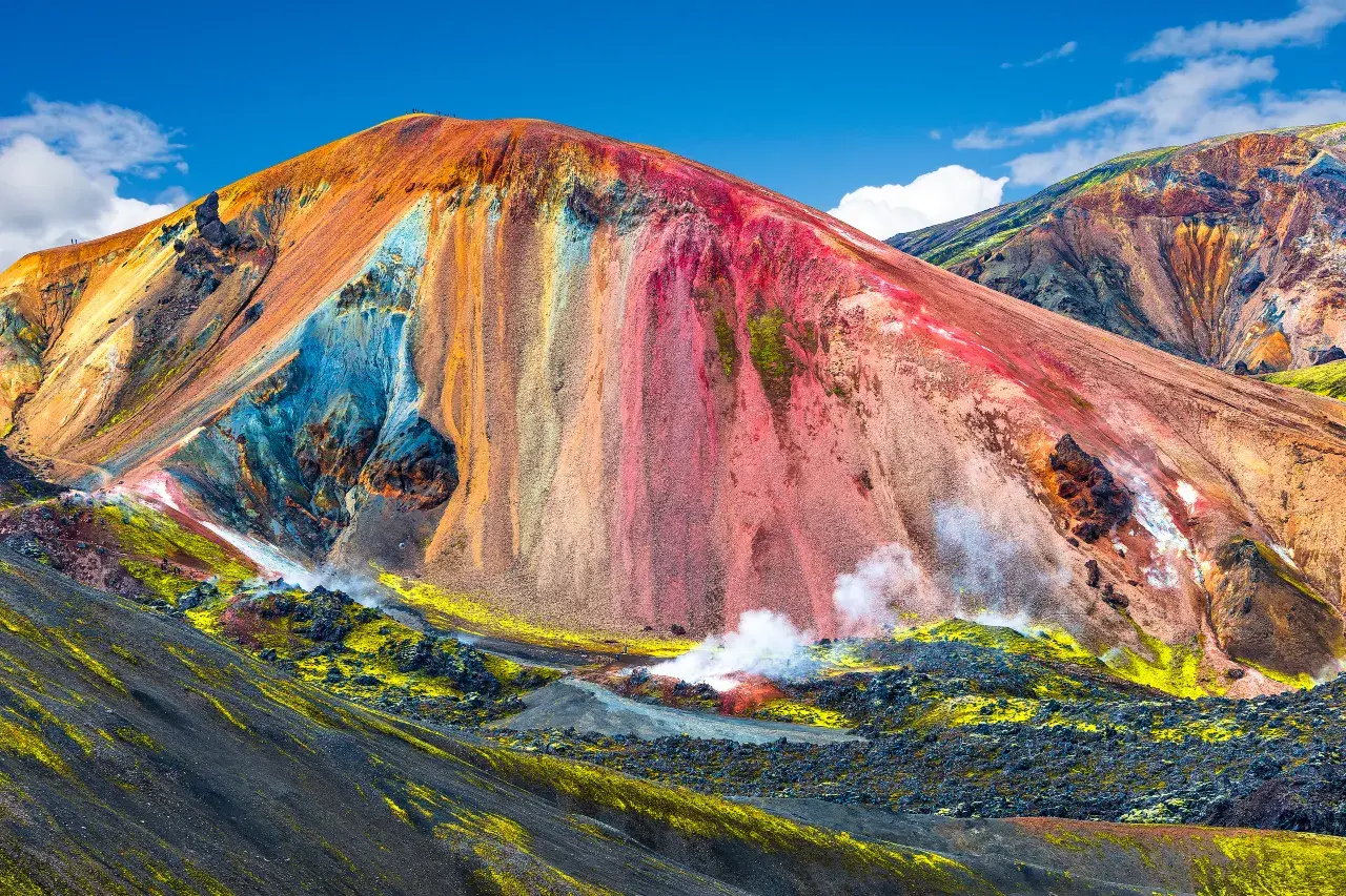
Bláhnúkur, the “blue peak”, adds a steep climb to a summit over glassy blue-black rock, with the lake Frostastaðavatn spread out below and the glacier country on the horizon. It combines naturally with the loop for a fuller day. For something quieter, the trails toward the Ljótipollur crater lake head out from the same trailhead complex and see a fraction of the traffic. Whatever you choose, the highlands’ walking rule is universal: stay on the paths, because the moss and soils recover at geological speed, not tourist speed.
- Laugahraun–Brennisteinsalda loop: ~4 km, 2–3 h, the signature hike — lava, steam and the sulphur-wave slopes.
- Bláhnúkur: steep summit climb, big views over Frostastaðavatn; pairs with the loop for a full day.
- Ljótipollur direction: crater-lake walks with a fraction of the crowds; check track conditions locally.
A Trilha Laugavegur
Landmannalaugar is where Iceland’s most celebrated trek begins. The Laugavegur runs roughly 55 km south to Þórsmörk, usually walked in four days, and it is effectively a highlight reel of the country compressed into one walk: rainbow mountains, black deserts, an obsidian canyon, green oasis valleys, hot springs, a glacial river crossing and finally the wooded folds of Þórsmörk itself. Huts and campsites sit at each stage, and the standard advice is blunt — book huts early, because the season’s beds are gone months ahead, and treat the weather forecast as a travel document.
The trail is graded moderate but lived experience says otherwise: snow patches can linger into the season on the high sections, wind regularly rewrites the day’s plan, and there are long stretches with no shelter and no water source except what you carry. Hikers new to Iceland should check trail conditions before setting out and file a travel plan on safetravel.is — the single habit that separates experienced highland walkers from rescue statistics. If four days is too much, the first stages out of Landmannalaugar make superb standalone day hikes.
O rio quente: como funciona o banho
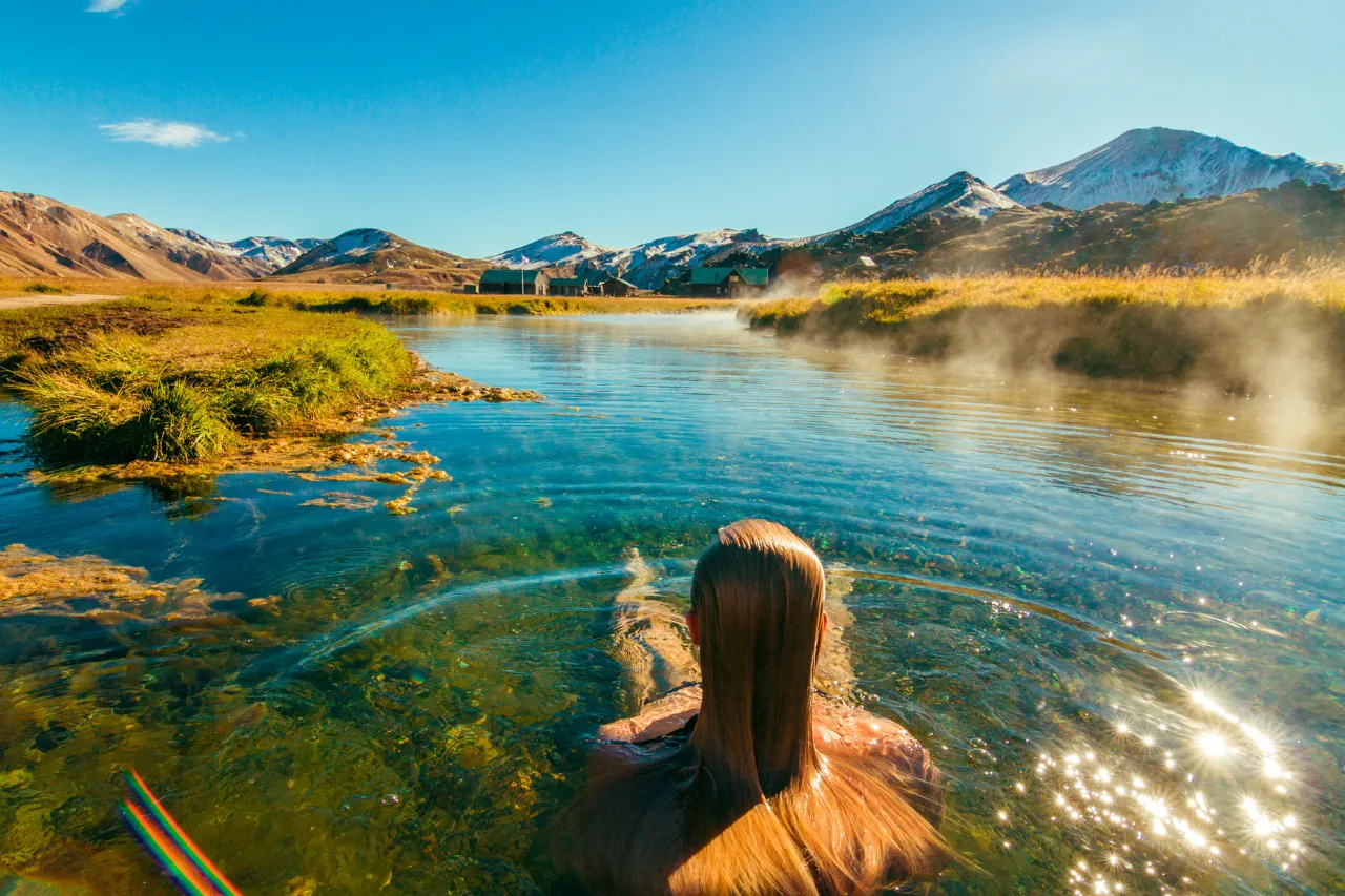
The bathing pool at Landmannalaugar is the best-earned soak in Iceland: after a hike through steaming valleys, you wade into a river stretch where geothermal water spills in from the hillside and mixes with cold current to bathtub warmth. The spot is free, open all season, and unmistakable — look for the steam and the line of towels on the lava. Depth and temperature shift with the season; a few steps along the bank usually finds the temperature you want.
The etiquette is national law: wash before entering shared bathing water — there is no shower house here, so the convention is a quick, discreet rinse at your vehicle or accommodation before you wade in. The ground near the pool is scalded and slick in places, so enter where others enter, keep children by the hand near the hot inflow, and remember that the highland wind will find you wet after the soak — pack the towel where you can reach it fast; the walk back to the bus is the coldest ten minutes of your trip.
Cabanas, camping e o que levar
The Landmannalaugar hut complex and adjacent campsite sit at the trailhead, semi-guarded in summer, with basic washing facilities and the atmosphere of a high-alpine basecamp. Camping means booking a designated site — wild camping is restricted in Iceland, and in the fragile highlands it is not even a grey area. The hut beds go early for the July–August window; the campsite is the usual fallback.
There are no shops at Landmannalaugar or on the approach roads — bring everything: food plus margin, water, warm layers, a shell, hat and gloves even in August, swimwear, a towel and blister care. Weather swings from shirt-weather to sleet in an afternoon; the layering system from our packing guide is not optional advice here. Footwear matters more than fashion: broken volcanic ground eats soft shoes — boots, not sandals, because the walk-in crossing uses the footbridge.
From real trips: arrive on the first bus and the valley is yours — silence, steam and empty trails for two hours, the crowds arriving as you soak. Late afternoon works almost as well; the evening light on the rhyolite is the softest of the day. Midday congestion at the hot river is the one slot we would actively avoid.
Regras de segurança, clima e F-road
The highlands punish improvisation. Weather changes are the headline: wind events can close roads and stop buses with a few hours’ notice, temperatures drop with elevation faster than the forecast implies, and the Fjallabak plateau has no shelter between huts. The protocol is simple: check the forecast and road status the evening before and the morning of, keep plans flexible enough to turn around, and file a travel plan on safetravel.is for anything beyond the trailhead loops. In an emergency, the number is 112, and the 112 Iceland app reports your location when you cannot.
For drivers, the F-road rules repeat because they matter: proper 4×4 only, contract permitting, no crossing rivers against the rental agreement, no off-road driving ever, and if the water or the track looks wrong, turn around — the highlands will still be there next summer. For hikers, the rules are softer but equally real: stay on marked paths, keep distance from steam vents and hot ground, and treat a darkening sky and rising wind as an instruction, not an atmosphere.
Além de Landmannalaugar
Landmannalaugar is the highlands’ headline, not the whole show. Þórsmörk, the trail’s southern end, is a sheltered valley of birch woods and braided rivers beneath three glaciers — greener, gentler, and the natural follow-up if the Laugavegur has hooked you. Askja, far to the northeast, offers a caldera walk and a swim in a milky crater lake for travelers with a serious vehicle and a full day. Kerlingarfjöll, in the island’s centre, pairs steaming geothermal valleys with mountain hiking and has become the highlands’ second most-photographed stop.
Each of these shares the same access logic — summer season, F-roads or highland buses, thin services and honest weather math. If Landmannalaugar is your first highland trip, let it teach you the system before you chase the remoter names.
Frequently asked questions
When is Landmannalaugar open?
The access roads typically open in late June and close in early October, with exact dates set by weather and snow each year — no fixed calendar. Buses run during the road season; winter access is expedition territory. Verify live status on road.is rather than assuming.
Do I need a 4×4 to visit?
Only if you self-drive the F208/F225 — a genuine high-clearance 4×4 with a rental contract that allows F-roads. Otherwise the summer highland buses from Reykjavik handle the journey, and guided 4×4 tours cover the middle ground. The bus is the option our team recommends for first-timers.
Is the hot river really free?
Yes — the bathing pool is natural and open to everyone, with no ticket. What you owe is etiquette: wash before entering, keep to the established entry spots, and leave no trace. The paid thing at Landmannalaugar is transport, and possibly a bunk for the night.
Can children handle the hikes?
The main loop is manageable for school-age children who hike, and the hot river sells itself. Keep them away from steam vents and the hot inflow, dress them in proper layers, and choose the morning window before wind and crowds build. The Laugavegur is a different conversation — an adult-level trek.
How do I book the huts for the Laugavegur?
Book as early as the system allows — peak-season beds sell out months ahead, and the stage huts are the bottleneck of the whole route. Stage campsites are the fallback, and walking in shoulder season eases both the competition and the crowds.
Keep planning the highlands
The Laugavegur ends in Þórsmörk — our hiking guide covers the valley, and the safety guide covers the rules of the interior.
Before you pack, run through the all-season packing guide for the layering system the highlands demand, check the camping & campervan guide if a campsite night is in the plan, and see where a hot-river soak fits among the best hot springs beyond the Blue Lagoon. The safety guide expands on the 112 and safetravel.is protocol every highland traveler should know.
Sources & official references
- Official Icelandic services: road.is (F-road status and opening windows), en.vedur.is (highland forecasts), safetravel.is (travel plans and highland safety), emergency 112 / the 112 Iceland app — checked 2026.
- Trip.com Iceland destination guide (checked 2026): Landmannalaugar profile, day-hike listings and highland transport framing.
- Fjallabak Nature Reserve and hut-system visitor information (protection rules, hut and campsite practices, Laugahraun 1477).
- Laugavegur Trail stage descriptions and booking practices as published for the 2025–2026 seasons.
- Editorial visits across seasons 2024–2026 by the Iceland Travel Guides team.
