

Sólheimajökull is the South Coast’s walk-up glacier: a tongue of the Mýrdalsjökull ice cap that slides off the highlands and ends in a melt lagoon 400 metres from the car park. It is the most accessible glacier lesson in Iceland — you watch the ice, the moraines and the retreat markers in one short walk — and the launch point for the South Coast’s glacier hikes and ice climbing. Free to approach (paid parking), 2 hours from Reykjavík, open year-round.
This is #23 of 39 in our Best Things to Do in Iceland guide (4.5/5 from verified visitors). Below: the walk and what you see, the retreat story (the tongue has pulled back kilometres in a lifetime), the guided hike options, the Katla context (the volcano under the ice), and the rules that keep a glacier viewpoint safe.
Points clés à retenir
- Walk-up glacier face: the tongue ends in a melt lagoon a short walk from the car park — the closest big-ice contact on the South Coast.
- The retreat is measurable: the tongue has withdrawn kilometres since the 1930s; the barren moraine between car park and ice is the evidence.
- Guided hikes and ice climbing: the tongue is the South Coast’s standard glacier-hike venue — crampons, guides, half-day formats year-round.
- Katla sits above it: the ice caps one of Iceland’s most active volcanoes — the “fire under the ice” lesson in one view.
- Free access, paid parking: open year-round; tours and gear are the paid layer.
Réponse rapide : Walk the moraine track from the car park to the lagoon (15–20 minutes, flat, otherworldly), read the retreat in the stripped hillsides, view the ice face from the marked viewpoints — and book a guided glacier hike if you want crampons on the ice. Never walk onto the glacier alone; the crevasses do not announce themselves.
The walk and the retreat lesson
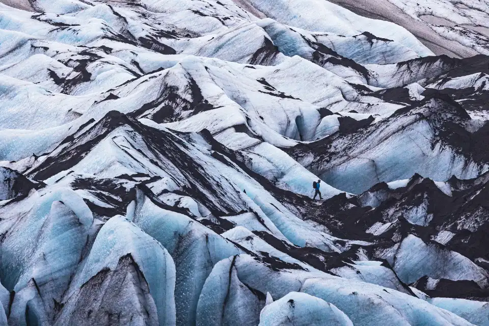
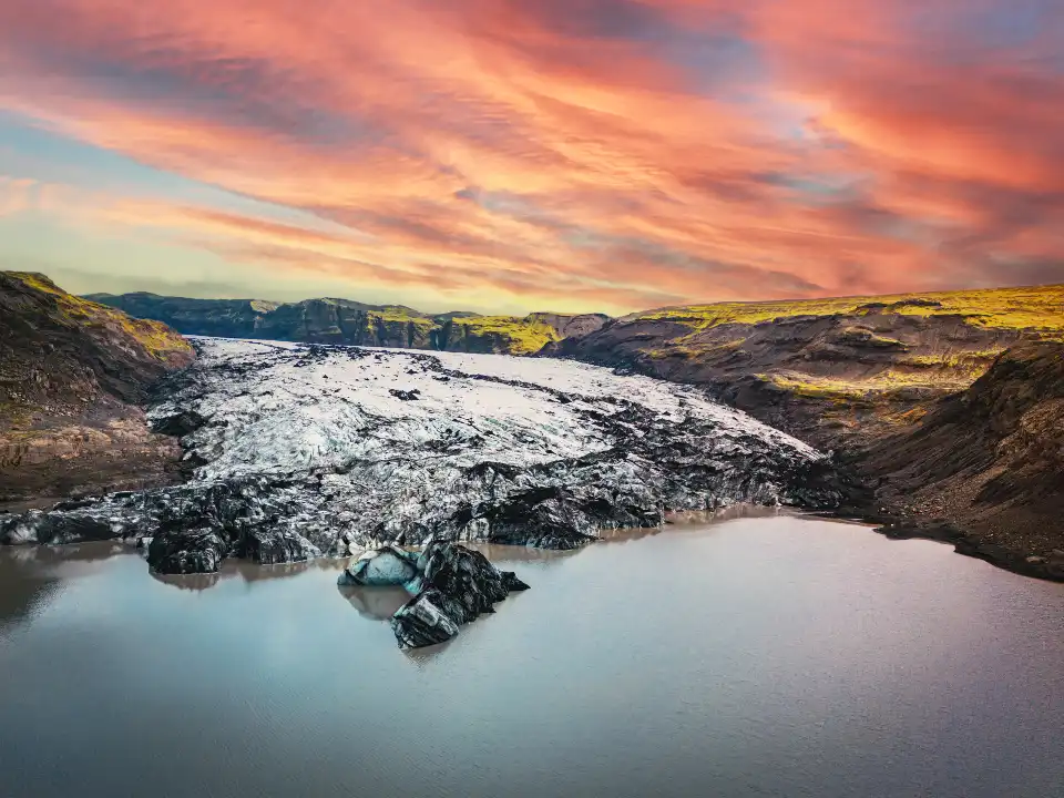
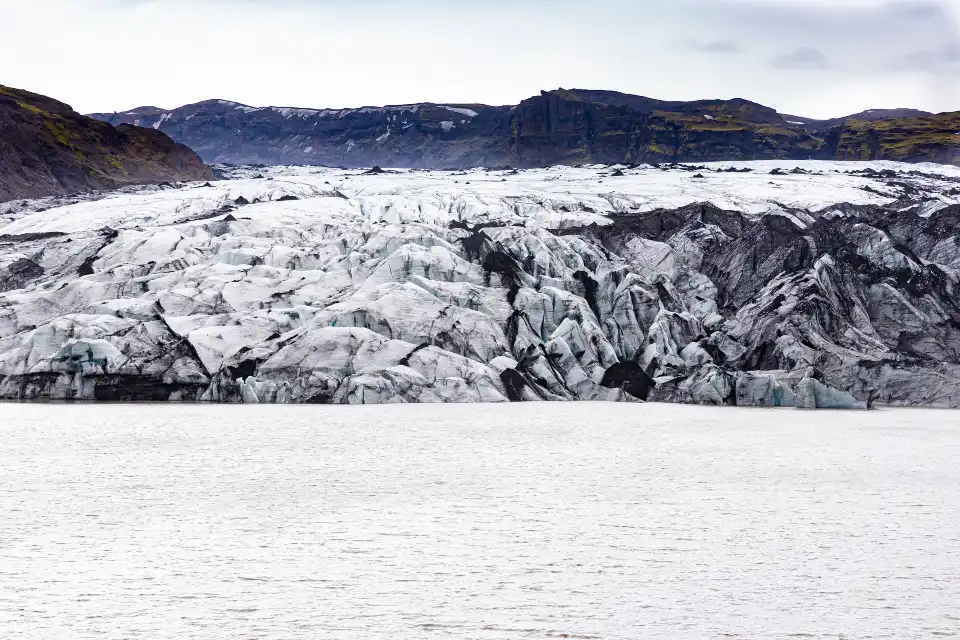
The visit is a walk through a glacier’s wake: the track from the car park crosses ground the ice occupied within living memory — scraped bedrock, boulder moraines, grey meltwater channels — to the lagoon where the tongue now ends. Icebergs calve off the face and drift the lagoon; the ice is grey-tinged with volcanic sediment, crevassed, and visibly alive. The retreat markers and the bare hillsides tell the story the signs only sketch: this tongue has pulled back kilometres since aerial surveys began, and the walk itself is the timeline.
The face itself is viewable from the marked viewpoints at the lagoon’s edge — close enough to hear it drip and crack, close enough to understand why the guided-only rule exists. The Katla context completes the lesson: Mýrdalsjökull, the cap feeding this tongue, sits over the Katla volcano, historically among Iceland’s most explosive — the ice above, the fire below, and the lagoon water grey with the grind of both.
Never walk onto the ice unguided: the tongue’s surface hides crevasses, ice caves and thin bridges over melt channels — every year unguided visitors are rescued (or worse) from exactly these glaciers. The lagoon-edge viewpoints are the safe contact; the ice belongs to the guides.
The guided hikes and ice climbing
Sólheimajökull is the South Coast’s standard glacier-hike classroom: operators run half-day glacier walks year-round (crampons, helmet, axe provided — basic fitness, ages ~10+), winter ice-climbing sessions on the tongue’s walls, and the Katla ice-cave variants from the Vík side in the cold months. The hikes cross real glacier terrain — moulins, crevasse fields, the blue ice under the sediment — with the guide’s rope discipline as the whole safety system.
Booking: tours run multiple daily departures from the Sólheimajökull car park and from Vík; winter slots book thinner but the ice is in better shape. From-prices sit in the standard glacier-walk band; the experience is the best-value ice contact after the blue caves (#2) — which are the premium version of the same lesson.
The kit reality: waterproof boots with ankle support (rentable), warm layers, gloves — the glacier is colder than the car park feels. Winter sessions add the operator’s outer kit; summer sessions still want real shoes, not sneakers.
Practical: access and the pairing
Access: signed off Route 1 between Skógafoss (#8) and Dyrhólaey (#25) — a 4-km side road to the paid car park. The approach walk is 15–20 minutes on gravel; strollers make it; the viewpoints are flat. Facilities: toilet at the car park; the South Coast strip carries everything else. The visit: 45 minutes for the walk-and-look, half a day with a booked hike.
Seasons: summer gives the long-light walk and the full hike programme; winter adds the ice-climbing and cave options, ices the lagoon edge, and wants the road check (the side road plows reliably). The stop pairs mechanically with the South Coast string — waterfall, glacier, beach in one day.
How it fits an Iceland route
Sólheimajökull slots into the South Coast day between Skógafoss (#8) and Dyrhólaey (#25), or as the dedicated half-day with a booked hike. The deeper ice experiences sit east: the blue caves (#2) and Skaftafell (#29) under the same national-park system. Our glaciers and ice caves guide covers the full system, and the Ring Road guide slots the stop into the loop.
Frequently asked questions
Can you walk on Sólheimajökull without a guide?
No — the glacier surface hides crevasses and melt-channel bridges; all ice access is through certified glacier guides. The lagoon-edge viewpoints are the safe unguided contact.
How much has Sólheimajökull retreated?
Kilometres in under a century — the tongue has withdrawn dramatically since the 1930s surveys, and the barren moraine you walk across is the measurable evidence. The retreat is one of Iceland’s most visible climate records.
Is the glacier hike suitable for beginners?
Yes — the standard half-day walk is a beginner format: gear provided, moderate fitness, ages ~10 and up depending on operator. Winter ice-climbing sessions are the step up.
What is the volcano under the glacier?
Katla — one of Iceland’s most historically explosive volcanoes, sitting under the Mýrdalsjökull cap that feeds this tongue. The grey sediment in the ice and lagoon water is the fire-and-ice mix in visible form.
Where this ranks — and what is next
Solheimajokull is #23 of 39 in our Best Things to Do in Iceland guide — the full ranked list, built from Trip.Best traveler data, lives in one place.
Go deeper: Glaciers and ice caves — the complete guide, Solheimasandur plane wreck — the neighbouring stop.
Sources & official references
- Trip.com listing for Solheimajokull: 4.5/5 rating (checked November 2026).
- Trip.Best ranking data: #23 of 39 (November 2026).
- Operator briefings: hike formats, seasons, safety systems (checked 2026).
- Retreat records per glacier survey literature and on-site markers.
- Editorial visits including guided hikes, 2023–2026.
