




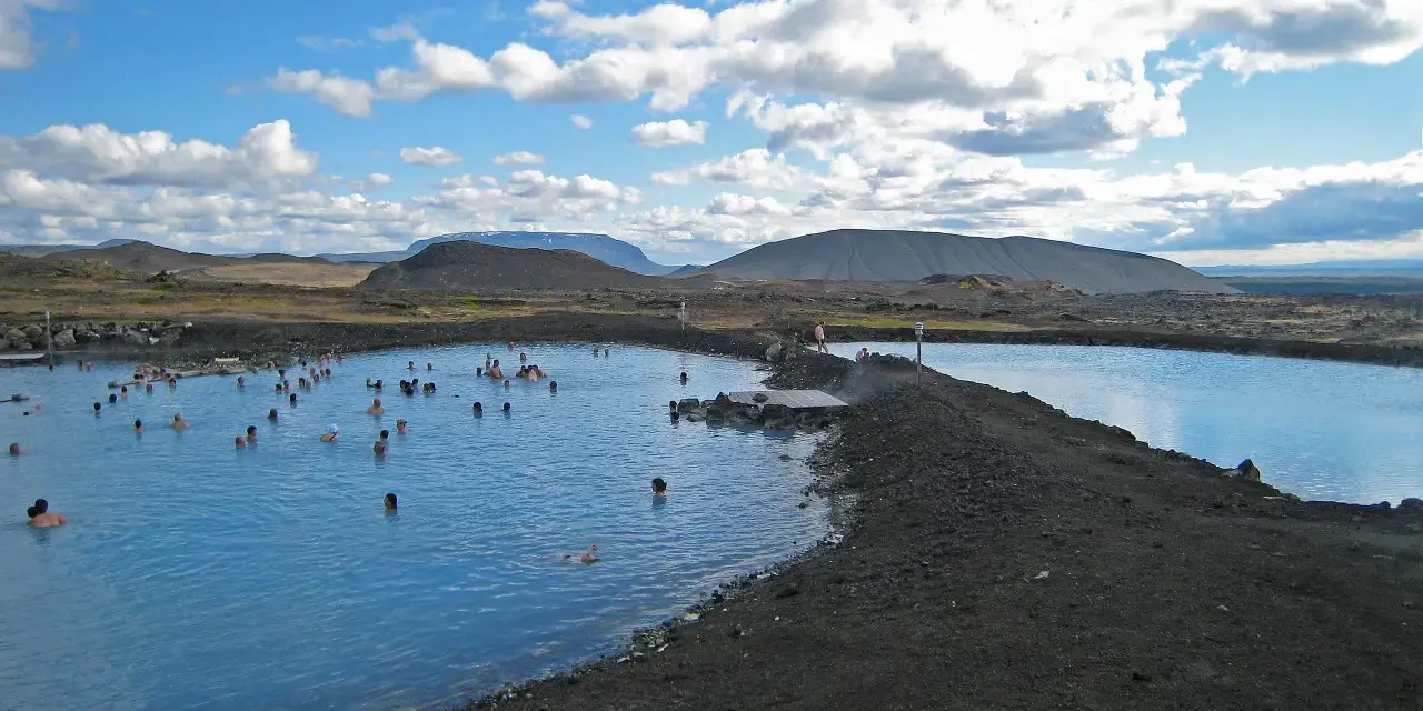
Northern Iceland answers a different question than the south coast. Instead of waterfalls-behind-each-other, it offers an arc of geothermal country around Lake Mývatn: boiling mud pools, a turquoise crater lake inside a volcano, lava fields that cooled within living memory, and a milky-blue lagoon where you can soak until your fingers wrinkle — usually with a fraction of the crowds you would meet in the southwest. Our team has spent more evenings here than we can honestly justify, watching humpbacks in Húsavík, steam rise off Hverir at midnight and the aurora stand over the lake in February, and this guide is the distillation: what to see, in what order, and how to handle the lake’s one genuine hazard, which is not geological at all — it is the midges.
Mývatn works as a two-night hub rather than a roadside stop. The lake district itself fills a day; Goðafoss sits on the drive; Dettifoss, Ásbyrgi canyon and the whale bay of Húsavík all fit inside an hour’s radius. Add the winter version — steaming lagoons under dark skies — and you have the best value region in the country for repeat visits.
Conclusiones clave
- The lake is young and strange: Mývatn — “midge lake” — was formed by eruptions roughly 2,300 years ago, and its shores are a maze of lava formations and pseudo-craters.
- Hverir is the signature stop: boiling mud pools and fumaroles with water at 80–100°C — spectacular, smelly and strictly a stay-on-the-paths place.
- Krafla and Víti reward the short drive: a volcano system with a pale blue crater lake, and the Leirhnjúkur lava fields still cooling from the 1984 Krafla fires.
- The Nature Baths run all year: a year-round geothermal lagoon that makes Mývatn a genuine winter destination, aurora included.
- July brings midges: the lake’s namesake insects are harmless but relentless — a headnet is the cheapest upgrade you will buy in Iceland.
Respuesta rápida: base in Reykjahlíð on the lake or in Akureyri about an hour west, give the lake district a full day (Hverir, Krafla, Dimmuborgir, the Nature Baths), then branch out — Dettifoss an hour east, Húsavík whale watching 45 minutes north, Goðafoss on the drive west. Fly to Akureyri to skip the six-to-seven-hour drive from Reykjavik; in winter, the baths and the aurora carry the trip on their own.
What Mývatn actually is
Mývatn translates, without euphemism, as “midge lake”, and the name is a promise the summer air keeps daily: the shallow lake breeds clouds of midges that swarm over the shoreline in warm months. They do not bite — the lake’s famous insects are harmless to humans — but they arrive in numbers that convert casual visitors into headnet owners within an hour. The name also hints at the lake’s deeper story: these midges anchor a food web that makes Mývatn one of Europe’s great waterbird sites, with more duck species breeding here than almost anywhere on the continent.
The district’s shape comes from eruption chains roughly 2,300 years ago. Lava from fires along a fissure east of the lake built the strange landforms that make a Mývatn drive feel like a tour of a cooling planet — shield volcanoes, dark fissures, and hundreds of pseudo-craters at Skútustaðagígar on the south shore, formed where lava flowed over wetland and steam explosions left rootless cones. None of this requires a geology degree to enjoy; the trails around the pseudo-craters are short, grassy and lake-fringed, and the birdlife keeps your eyes busy between stops.
Hverir, Krafla and the Víti crater
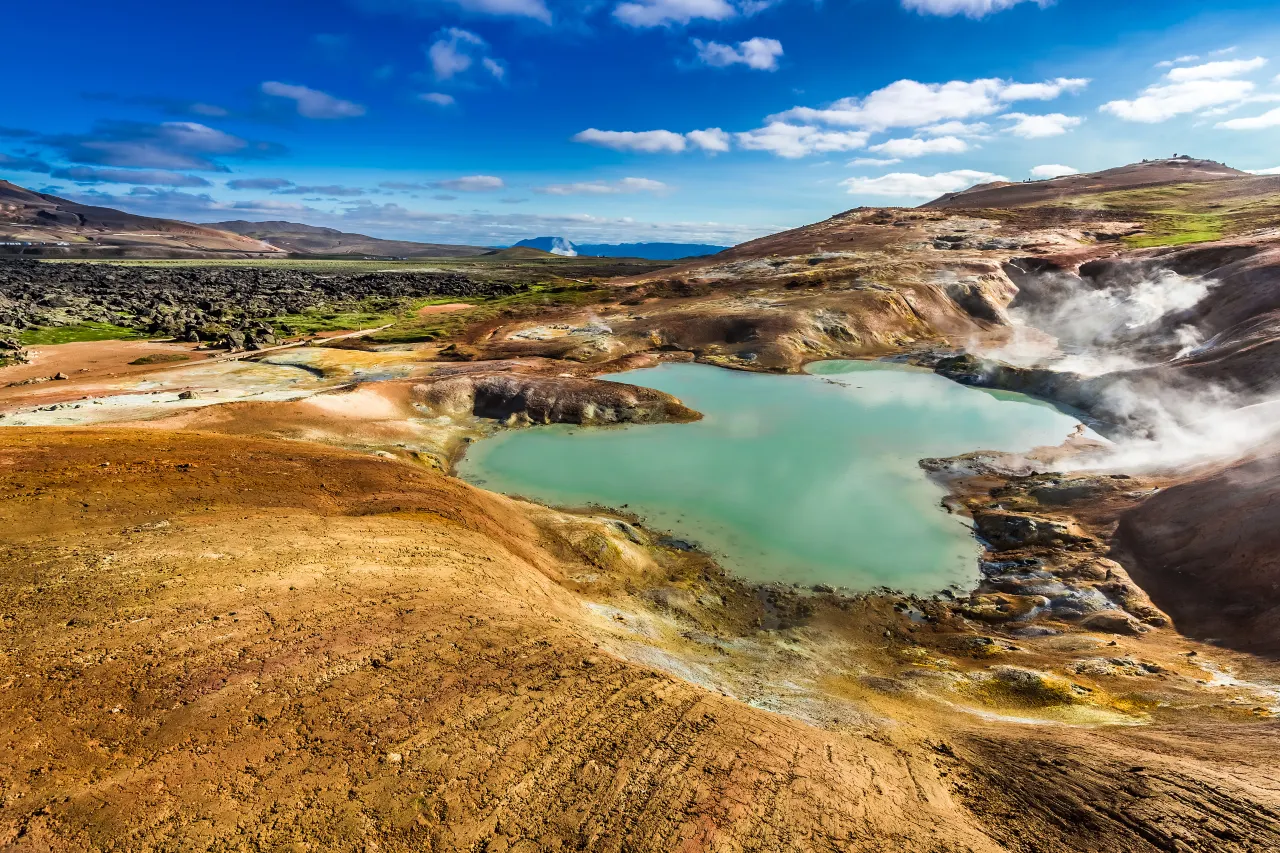
Hverir (at Námaskarð, on the pass east of the lake) is the stop everyone remembers, mostly by smell — the sulphur announces itself before the car doors open. The ground here boils openly: mud pools pulse and spit, fumaroles whistle steam from vents, and mineral staining paints the slopes in rust, mustard and chalk white. The water feeding all of it runs at 80–100°C, which is why the area is fenced and the paths are law: ground here can be a thin crust over scalding mud, and the steam burns. Twenty unhurried minutes on the marked loops is enough to feel you have visited another planet without becoming part of its experiments.
A short drive up the mountain road brings you to Krafla, one of Iceland’s most active volcanic systems. The Víti explosion crater at the top holds a pale, milky-blue lake inside a perfect bowl — the same name as Askja’s famous crater pool, and nearly as photogenic from the rim. Below it, the Leirhnjúkur lava fields tell the system’s recent history: during the Krafla fires that ran through the 1970s and 80s, eruptions reopened fissures across the area, and the 1984 flows here hardened into black rock that in places still steams. Walk the marked paths out to the vents — you cross ground that was liquid within living memory, with orange earth and hissing cracks underfoot.
Vale la pena saber: Hverir and Krafla sit close enough to combine in one leg, but the mountain road to Víti is narrow and exposed to weather; in wind, treat the crater rim walk with respect. Boardwalks and marked paths exist for good reasons — every off-path “shortcut” here crosses ground that scalds.
Leirhnjúkur, Dimmuborgir and the pseudo-craters
Dimmuborgir — “dark castles” — is the lake’s fairy-tale district: a field of lava that pooled over marsh and drained, leaving towers, arches and hollows you can wander through on signposted loops. It is the easiest walking in the district, family-friendly and strangely theatrical, and local folklore has claimed it as the home of trolls; at Christmas, the Yule Lads supposedly pass through on their way down from the mountains. The name has had a second life as a metal band’s moniker, which the lava field wears with characteristic Icelandic indifference.
The south shore belongs to Skútustaðagígar, the pseudo-crater field, where short trails link grassy cones above the lake — perfect terrain for an evening walk when the light goes gold. Between these stops, keep an eye on the water itself: barrow’s goldeneyes and harlequin ducks — species birders travel continents for — ride the lake’s currents in summer, and the shoreline meadows hum with the previously mentioned midges. The whole district is walkable in stops of twenty to sixty minutes, which is the practical charm of Mývatn: no single hike dominates, and the day accumulates impressions rather than kilometres.
The Mývatn Nature Baths
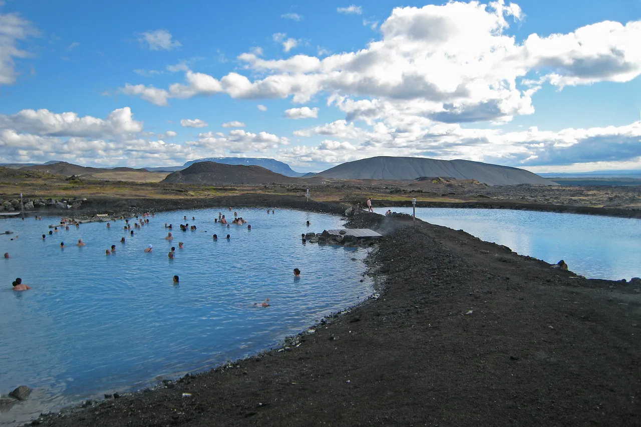
Jarðböðin — the Mývatn Nature Baths — is the district’s social centre and its evening ritual: a milky-blue lagoon of geothermal water on a hillside above the lake, with views over volcanic country that change character by the hour. The water is mineral-rich, faintly sulfuric and famously good for skin; the lagoon is smaller and calmer than the Blue Lagoon, and the atmosphere is closer to a community soak than a spa production. It runs year-round, which makes it one of the country’s best winter plans — steam rolling off the surface at minus ten with aurora overhead is a genuinely hard memory to beat.
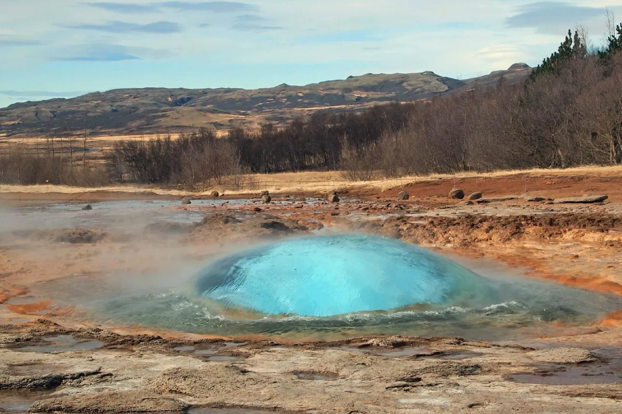
Practicalities follow the national bathing code: full wash before entering, swimwear required, towels rentable, and the entry is paid at a mid-range level comparable to the country’s other lagoons. Times shift with the seasons — long evenings under the midnight sun, short blue hours in winter — so check current opening hours when you build the day. Our team’s pattern is simple: hikes and Hverir in the afternoon, baths at dusk, dinner after, and if the aurora forecast is green, stand back outside and watch the sky do the encore.
Goðafoss: the waterfall of the gods
On the road west toward Akureyri, the river Skjálfandafljót drops over a wide horseshoe about 30 metres across and roughly 12 metres deep in a single elegant curtain: Goðafoss, the waterfall of the gods. The name carries the story — when Iceland adopted Christianity at the Althing around 1000 AD, the lawspeaker Þorgeirr is said to have thrown his pagan idols into the falls, sealing the conversion with the country’s old gods at the bottom. Whether the tale is history or folklore, the falls wear it well; few places in Iceland blend narrative and geology this neatly.
The visit is short and satisfying: paths on both banks, a viewpoint over the horseshoe where the whole width of the fall shows at once, and a lower trail that puts you level with the river for the water-level perspective. In winter the falls freeze into an ice sculpture that photographers plan entire north trips around; in summer the midnight light does the same job for free. It sits directly on the main road, which means it is also the busiest stop in the region — early or late beats noon by a mile.
Bases and the north loop: Dettifoss, Húsavík, Ásbyrgi
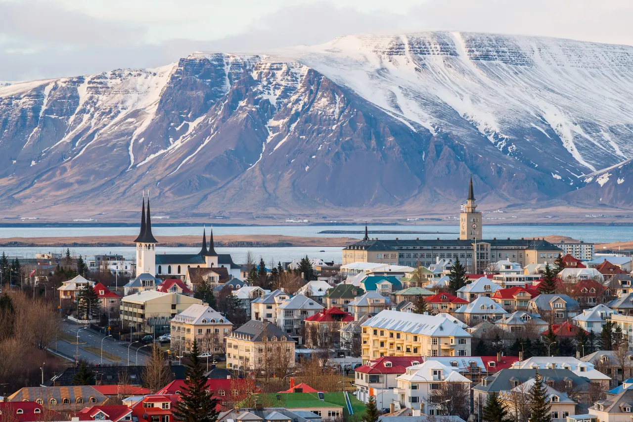
Two bases cover every style. Reykjahlíð and the lake villages put you inside the district — walks before breakfast, baths after dinner — with small-shop practicality rather than city services. Akureyri, about an hour west, is the capital of the north: restaurants, accommodation for every budget, an airport with flights from Reykjavik that erase the six-to-seven-hour drive, and its own city attractions worth a half-day. The drive from the southwest is long but paved and scenic; the flight is the honest time-saver for short trips.
From either base, the northeast loop fills two more days effortlessly. Dettifoss — Europe’s most powerful waterfall by volume — runs about an hour east, with the horseshoe of Selfoss just downstream. Húsavík, 45 minutes north, is the whale-watching capital, where oak boats cruise Skjálfandi Bay past surfacing humpbacks. Ásbyrgi, the horseshoe canyon at the delta, adds vertical walls and a woodland floor to the same day out. Our dedicated guides cover each in depth: read the Dettifoss guide, the Húsavík whale-watching guide and the Akureyri city guide before you lock the itinerary.
Summer midges vs winter aurora
Summer (June–August) is the district at full power: birdlife, hikes, Hverir in the long light, whale season in Húsavík and the midnight sun stretching every day. The cost is the midges — worst in the still, warm weeks of July, worst at the shoreline, and fully manageable with a headnet and a breeze. Crowds cluster at Hverir and Goðafoss midday; the rest of the district absorbs people easily.
Winter (November–March) inverts the offer: the trails quiet down, the baths steam, the aurora has dark skies free of southern light pollution, and ice sculptures rebuild Goðafoss. Roads stay ploughed most days but weather closes them on the region’s storm cycles — check road.is and the en.vedur.is forecast, and keep a slack day. Shoulders (May, September) split the difference beautifully: birdlife and baths without the July midge peaks, and the season’s first and last aurora windows. The district is one of the few in Iceland where we genuinely cannot pick a “best” month without knowing whether you are coming for ducks or for lights.
Frequently asked questions
How bad are the midges at Mývatn, really?
Bad enough to earn the lake its name, harmless enough that everyone survives them. They swarm most heavily in warm July weather near the shoreline, and they do not bite. A headnet — a few hundred kronur anywhere in the region — plus any wind at all makes the difference between annoyance and non-event.
Can I visit Mývatn as a day trip from Reykjavik?
Technically, at roughly six to seven hours of driving each way — but our honest advice is no. Base at the lake or in Akureyri for at least a night; the district plus the north loop deserves two to three days, and the flight to Akureyri makes that affordable in calendar terms.
Is Hverir safe for children?
On the paths, yes — and only on the paths. The ground outside the marked areas is thin crust over boiling mud, and the steam vents run at 80–100°C. Keep children on the boardwalks and within arm’s reach; the spectacle is best enjoyed with intact skin.
Are the Mývatn Nature Baths suitable in winter?
They are one of the best winter experiences in Iceland — the lagoon runs year-round and the contrast between steaming water and cold air is the point. Bring a warm hat for the walk from the changing rooms, watch icy patches, and check seasonal opening hours before planning the evening around it.
What should I pair with Mývatn?
The northeast loop: Dettifoss and Selfoss about an hour east, Húsavík whale watching 45 minutes north, Ásbyrgi canyon on the same circuit, and Goðafoss on the drive west. With two nights you cover the lot without rushing; our individual guides for Dettifoss, Húsavík and Akureyri slot straight into the plan.
Build the north loop
Mývatn is the hub — Dettifoss and Húsavík are the spokes, and our guides cover both.
For the wider region, our Akureyri guide covers the north’s capital, the hot springs beyond the Blue Lagoon ranks the region’s lagoons, and the northern lights guide explains why the winter skies here outperform the south. Season planning lives in our weather & wind guide.
Sources & official references
- Official Icelandic services: road.is (northeast road status), en.vedur.is (weather and aurora forecasts), safetravel.is (geothermal-area safety) — checked 2026.
- Trip.com Iceland destination guide (checked 2026): Mývatn district profile, Hverir and Nature Baths listings, formation dating (~2,300 years) and regional itineraries.
- Vatnajökull National Park and regional visitor information: Krafla fires history, Víti crater, Dimmuborgir and Skútustaðagígar formation notes.
- Goðafoss naming tradition (Þorgeirr, adoption of Christianity at the Althing around 1000 AD) from Icelandic heritage sources.
- Editorial visits across seasons 2024–2026 by the Iceland Travel Guides team.
