









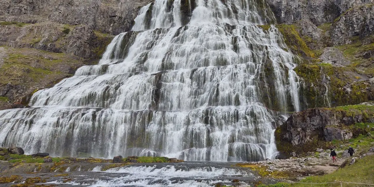
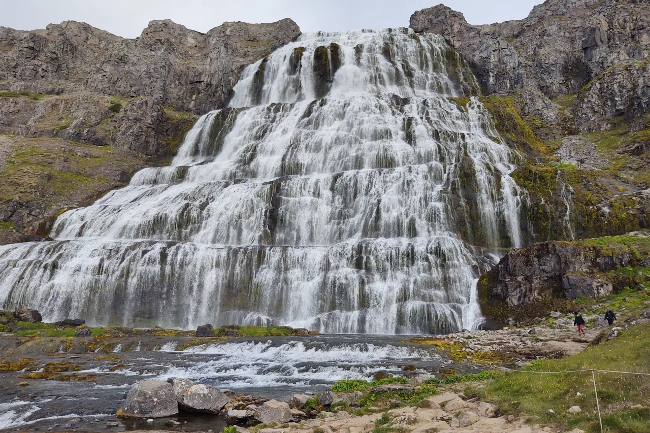
This is spot 11 of 20 in our Iceland Photography Guide — the Westfjords’ jewel. Dynjandi (also called Fjallfoss at its top tier) is the master list’s remote-audience pick: a fan of seven cascades stacked about 100 metres up a hillside above Arnarfjörður, widening from a narrow ribbon at the crest to a broad curtain at the base. The master guide’s field tip names the light and the detail — “tiered falls love flat light; the mossy stream pools are the detail shots” — and both halves are true: gray days are Dynjandi’s best days, and the small pools and channels between the tiers are where the portfolio lives.
Dynjandi is also the stop that justifies a Westfjords itinerary at all: it sits a couple of hours’ driving beyond anything on the main tourist circuit, which means empty paths, all-day parking and a scale of quiet that the south coast has forgotten. This guide covers the access (including the gravel spur and the walk), the tiered compositions, the flat-light logic, and how the falls anchor a Westfjords loop.
Key takeaways
- Gray days are the good days: tiered water against dark rock reads cleanest under even sky — the master list’s “gray day drama” is the plan, not the fallback.
- Shoot the tiers as a sequence: base curtain, mid-tier channels, crest ribbon — three stops up the one trail, three different photographs.
- The mossy stream pools are the detail shots: exactly as the master tip says — small frames, low angle, 1–4 s, the pools and channels between tiers.
- Access is a short steep walk: car park at the base, a signed 15–20 minute path climbing past the tiers; sure-footed and wet, not technical.
- It is the Westfjords’ anchor: pair it with the fjord road’s empty coastline — the drive is half the day and half the reason.
Quick answer: take Route 60 to the signed Dynjandi spur, park, and climb the tiered path stopping at every level — base first (16–35 mm, tripod, 1–4 s), then mid-tier channels and pools (50 mm, f/8, the master tip’s detail shots), then the crest ribbon with the fjord beyond. Shoot it in gray light by preference; if the sun is out, work the pools’ reflections and wait for cloud breaks. Budget half a day including the fjord-drive approach.
Access: the spur, the lot and the climb
Dynjandi sits on the western shore of Arnarfjörður, reached from Route 60 by a short gravel spur — the last stretch is narrow but maintained, and ordinary cars handle it slowly in dry weather. The car park at the base is modest and (as of our last visits) charges a small fee in season; toilet facilities exist; the path up is a signed, stepped-and-graveled route that climbs past the tiers for fifteen to twenty minutes. It is steep and perpetually wet — boots with grip, not trail-runners, and a rain cover that survives drizzle.
The climb is the composition map: each tier has a pull-off or path shoulder where the tripod stands, and the falls’ seven sections each have names (Fjallfoss the top, then Göngufoss,Úðafoss… down to Hrísfoss and Svartifoss at the bottom) — photograph them as a sequence rather than hunting one hero angle. The crest viewpoint looks down the fjord with the top ribbon in frame — the “falls and the fjord” shot, best when gray cloud sits on the water.
Check road.is for the spur in winter — the Westfjords’ mountain roads clear late and close often; Dynjandi is effectively a summer-and-shoulder-season subject from the road, though the fjord-side viewpoints photograph it year-round when conditions allow.
The flat-light logic
The master guide’s “tiered falls love flat light” is a physics statement dressed as a tip. Seven stacked water curtains over dark rock produce extreme native contrast: bright sun turns each tier into a blown white blob and the moss into shadow soup; even overcast holds every tier inside the histogram and lets the water’s structure — the fan, the braids, the channels — read as the subject. Gray is the condition the falls were shaped for photographically, which is why the master list gives Dynjandi “gray day drama” as its best light.
Sun is not useless: clearing clouds after rain brighten the hillside greens and can backlight the crest mist; evening side-light models the tiers’ ridges; and the fjord beyond photographs its own weather at any hour. The rule is sequencing, not avoidance: work the tiers in gray, work the fjord-and-crest frames whenever the sky does something.
Rain multiplies the flow — Dynjandi after heavy weather is dramatically louder and fuller than in dry August. The en.vedur.is precipitation clock matters more here than the sun clock; a wet, windless gray day is the perfect Dynjandi window, and they are common in the Westfjords.
Compositions that work
The falls are a vertical composition system; the climb is the portfolio:
- The base curtain: from the path’s first level, 16–35 mm, the widest tier filling the frame with moss and channels leading in. Tripod, 1–4 s, polarizer for the wet rock.
- The master-tip detail shots: the mossy stream pools between tiers — low angle, 50 mm, f/8, 1–4 s, the pool’s still surface carrying a reflected ribbon of the fall above. These small frames are the ones that make a Dynjandi gallery look like a photographer’s, not a tourist’s.
- The fan overview: from mid-height, the whole stack — all seven tiers from crest to base against the fjord behind. Vertical, f/11, the climb’s payoff frame.
- The crest and the fjord: from the top viewpoint, the upper ribbon with Arnarfjörður’s water beyond — the composition that ties the falls to their place, best under fjord-hugging cloud.
Scale note: the tiers are big but read as texture from distance — the human figure on the base path remains the best size reference, and the empty Westfjords paths make one easy to wait for.
Settings and technique
The water divides into fast ribbons and slow pools — different shutter languages in the same frame. The curtain tiers take 1–4 s (structure retained, surface smoothed); the pools take 1–8 s (mirror-still under the ribbon’s motion); the detail frames often want both in one exposure, which is why the tripod carries everything and the polarizer rotates per frame — on for the rock, off for the pool reflections.
Exposure on gray days is forgiving (the even sky is a giant softbox), but the white tiers still clip: meter for the water, RAW, watch the histogram’s right edge. Spray is present at the base tiers on any decent flow — the cloth cycle from the south-coast falls applies in miniature. The climb itself argues for the one-body-one-zoom kit: two lenses flapping on a steep wet path is how straps and lenses die.
Wind on the exposed crest viewpoint is genuine Westfjords wind — the master guide’s anchor-the-tripod rule applies at the top; the mid-tier positions are sheltered and calmer.
The Westfjords context
Dynjandi is the Westfjords’ signature stop and the natural gateway to the region’s loop: the fjord road south toward Þingeyri’s sandbank and the cliff faces, north toward Hólmavík and the Strandir coast, or up to the remote Látrabjarg bird cliffs in the far west. Our Westfjords remote travel guide covers the region’s logic — the distances are honest (everything is a couple of hours from everything) and Dynjandi is the one stop every first visit should include.
Accommodation logic: Þingeyri and Flateyri are the nearest villages; Ísafjörður (the region’s capital, forty minutes north) is the practical base — fuel, food, and the fjord-side evening light on the drive back.
Seasons and the fjord road
Summer (mid-June through August) is the reliable window: the spur is clear, the moss is green, and the Westfjords’ famous gray-and-moist summer is precisely Dynjandi’s photographic best. September extends the season with emptier roads and stronger weather drama. Winter belongs to the fjord viewpoints rather than the climb (ice makes the path genuinely hazardous), and spring is the thaw-and-mud shoulder. The master list’s “gray day drama” is a summer promise in the Westfjords — the season delivers it weekly.
Pair the falls with the fjord drive’s own subjects: the coastal cliff faces, the empty gravel beaches, the roadside waterfalls that outnumber Dynjandi’s tiers. The Ring Road guide explains why the Westfjords is the great detour from it — the region is the one place Iceland’s main circuit does not reach.
Frequently asked questions
Is Dynjandi worth the Westfjords detour?
For photographers, yes — it is the master list’s only Westfjords entry, the region’s signature subject, and the empty paths alone justify the extra driving. Fold it into a real Westfjords loop rather than a Dynjandi-only dash; the fjords themselves are the second subject and the drive is the third.
Why gray light instead of sun?
Stacked water curtains over dark rock have extreme native contrast — even sky holds every tier in the histogram and lets the water’s structure read; sun blows the tiers and hides the channels. The master list’s “gray day drama” is the condition the falls photograph best in, and the Westfjords supplies it regularly.
How hard is the climb with gear?
Fifteen to twenty minutes on a steep, maintained, perpetually wet path — sure-footed boots, one body, one zoom, tripod slung. Every tier has a shoulder to stand and shoot from; nothing technical, just wet. Rain cover on; the drizzle here is constant rather than dramatic.
Can I photograph Dynjandi in winter?
From the fjord-side viewpoints, yes, when roads allow — the falls partially freeze into a single ice curtain and the scene changes genre entirely. The tiered climb is not a winter activity; check road.is for the spur and treat the fjord viewpoints as the cold-season answer.
The full field list lives in one place
Spot 11 of 20 — the master guide ranks all twenty locations by region, best light and a field tip for each.
Go deeper: the Westfjords remote travel guide for the region loop, the weather planning guide for the gray-day logic, and the Ring Road guide for how the detour fits the circuit.
Sources & official references
- Cascade structure (seven tiers, ~100 m total) per site interpretation materials and published survey figures.
- Access, parking and path status: Dynjandi visitor area signage; winter road status per road.is (checked 2026).
- Weather patterns: en.vedur.is forecasts for the Westfjords.
- Field technique and seasonal notes: editorial photography trips 2022–2026 by the Iceland Travel Guides team.
- Master list context: Iceland Photography Guide — 20 Best Photo Spots (this site).
