






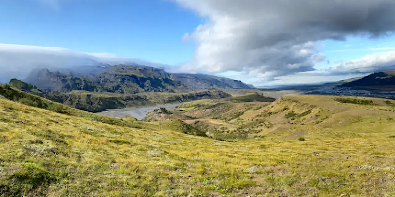
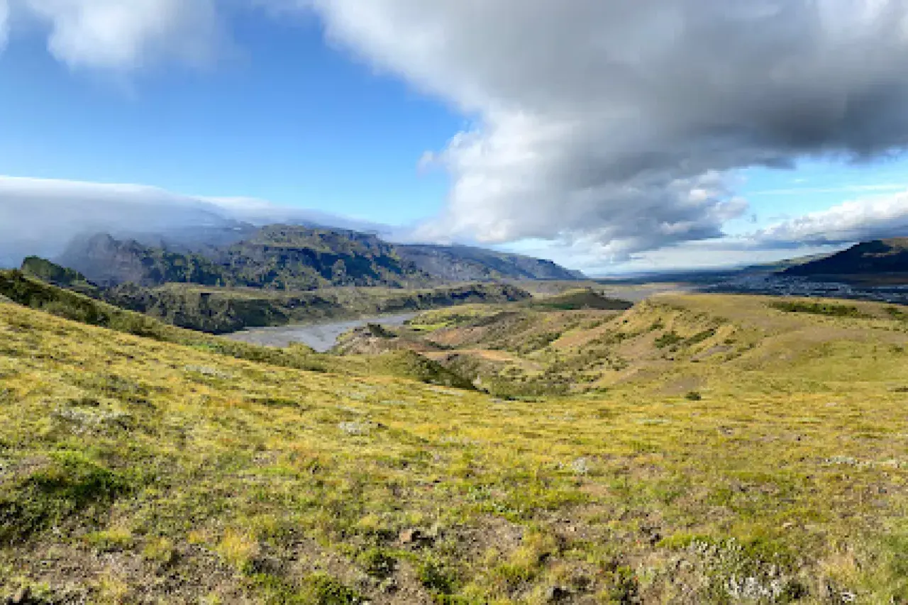
Halfway between the tourist pull-offs of the south coast and the raw highlands, there is a valley that feels like it was designed by a landscape architect with a mandate for excess: Þórsmörk, “Thor’s forest”, a bowl of birch woods and green ridges sheltered on three sides by glaciers — Eyjafjallajökull, Mýrdalsjökull and Tindfjallajökull. Glacial rivers braid across its floor, footbridges replace fords, and the trails range from an hour-long ridge viewpoint to one of Europe’s great multiday traverses. Our team considers Þórsmörk the single best hiking destination in Iceland that a motivated beginner can reach, and one of the hardest places on the island to leave.
It is also logistics-heavy in a way the south coast never is: summer-only access by modified highland buses, hut and campsite bookings that sell out months ahead, and weather that can rewrite a plan in an afternoon. This guide is the complete picture — how to get in, where to sleep, which day hikes actually deliver, how the Laugavegur and Fimmvörðuháls routes connect here, and the safety habits that make the difference between an epic and an ordeal.
Key takeaways
- Three glaciers, one valley: Þórsmörk is sheltered by Eyjafjallajökull, Mýrdalsjökull (home to the Katla volcano) and Tindfjallajökull — the microclimate that gives the valley its improbable green.
- Summer-only, bus-only: access runs over the braided Krossá river with modified 4×4 highland buses — ordinary cars cannot cross, and the season is strictly the summer months.
- Two base camps: the Langidalur huts and campsite (Ferðafélag Reykjavíkur) and Básar (Ferðafélag Árnesinga) anchor the valley; book early, especially for July and August.
- Big trails end here: the Laugavegur trek finishes in Þórsmörk, and the Fimmvörðuháls pass (~16 km, 23 waterfalls, the 2010 eruption craters Magni and Móði) links it to Skógar.
- Easy rewards too: the Valahnúkur viewpoint hike takes roughly 1–1.5 hours and delivers the valley’s signature panorama — no expedition required.
Quick answer: give Þórsmörk two days — bus in, hike Valahnúkur in the evening light, sleep in a hut or tent, then spend day two on a longer loop or start a traverse. Book huts and bus seats weeks ahead for midsummer, keep the weather forecast in charge of your schedule, and never plan a hard same-day deadline: the Krossá crossings and mountain weather set the timetable.
Why Þórsmörk feels like another country
Everything about Þórsmörk contradicts the postcard version of Iceland. Instead of black sand and treeless horizons, you find a sheltered valley of Arctic birch woodland, ferny slopes and flower-strewn moraines, cradled between three ice caps. The glaciers explain it: their mass protects the valley from the worst of the Atlantic weather while their meltwater feeds a spider’s web of braided rivers — above all the Krossá, a cold, powerful, constantly rearranging channel system that defines the valley’s edges and its access.
The valley carries its mythology in its name: Þórsmörk is Thor’s forest, and a statue of the hammer-wielding god stands in the valley, watching over a landscape that the sagas would recognize. Our honest description for first-timers: imagine the green hills of a temperate fairy tale, then insert glaciers on every skyline and volcanoes under the ice. That combination — Eyjafjallajökull, of 2010 eruption fame, is literally one of the walls — is why hikers plan whole trips around this one valley.
Getting there: highland buses & the Krossá
There is no do-it-yourself route into Þórsmörk for ordinary vehicles. The access tracks cross the Krossá and its braided channels, which shift course constantly — the valley’s entrances are only truly passable by modified highland buses with the power, clearance and driver judgment for the job. Scheduled highland buses run in the summer season from the Reykjavik direction and from the Hvolsvöllur area, delivering hikers to the valley’s main hubs; some services continue over toward Landmannalaugar connections. The rule is simple: book bus seats ahead in high season, and treat the timetable as seasonal and weather-dependent rather than year-round infrastructure.
- No ordinary cars: highland tracks are closed to standard vehicles, and 4×4 rules apply to any attempt — F-road discipline from our driving guides is the baseline, not an option.
- Status checks: verify route openings on road.is before travel day; storms and meltwater close tracks without notice.
- Within the valley: the Krossá’s key crossing points have footbridges — the trails are designed to keep you out of the river. Stay on them; glacial water is colder and stronger than it looks.
- Pack for the bus: everything you need comes in with you; there is no resupply shop worth counting on mid-valley.
Huts, campsites & booking strategy
Two main hubs organize the valley. Langidalur, at the valley’s mouth near the bus turnaround, is run by the Reykjavik hiking association (Ferðafélag Reykjavíkur) with hut accommodation and a campsite. Básar, on the valley’s eastern side, belongs to the Árnes hiking association (Ferðafélag Árnesinga) and pairs its huts with a lovely riverside campsite. Both follow the classic Icelandic hut model: shared dormitories, basic facilities, wardens with the local knowledge that no app replaces, and a drying room whose value is hard to overstate after a wet pass day.
Book early — genuinely early. July and August hut beds fill months ahead, campsites are the practical fallback but bring real camping discipline (wild camping is not an option; designated sites only, per national rules), and if you are hiking the big traverses, book each night’s bed separately and confirm connections. A tent night in Þórsmörk between the glaciers is one of Iceland’s great camping experiences — our camping & campervan guide covers the gear list that makes it comfortable.
Day hikes: Valahnúkur & the loops
You do not need a trek to earn Þórsmörk’s best view. The Valahnúkur ridge rises from the valley floor and delivers, in roughly 1–1.5 hours from the trailhead area near the huts, the panorama that sells the valley: glacier tongues on both flanks, the birch wood below, braided rivers stitching it together. The climb is steady rather than technical; after rain the upper sections turn slick, so boots with grip earn their keep. From the nearby pass area, the Sónguhell cave adds a short detour with its own slice of valley history.
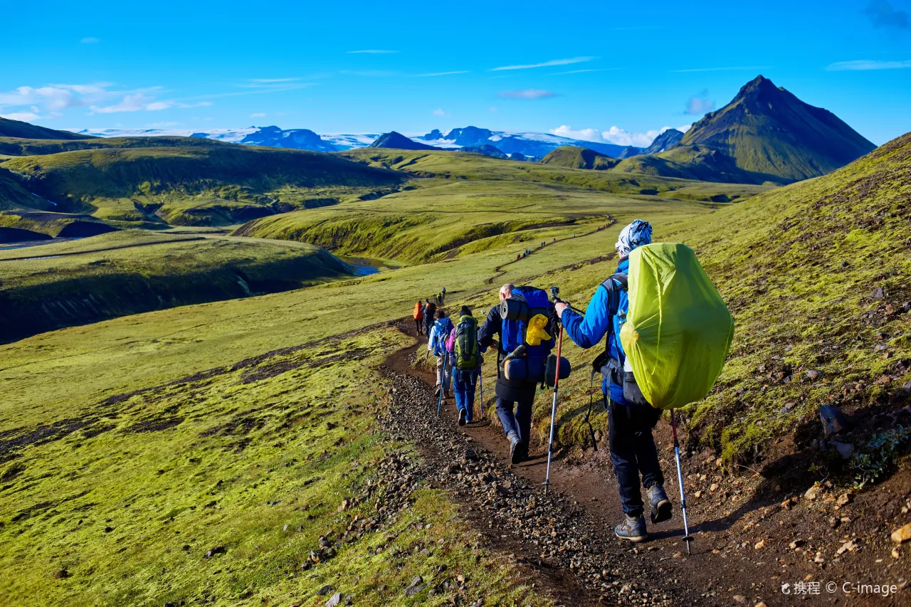
For a fuller day, the loop over and around the Stóra-Endurfergi ridge circuit delivers ridge-walking with constant valley-and-glacier vantages, and combinations of the marked trails let you tune the distance. The valley’s trail network is signed and well-trodden, but remember the cardinal Þórsmörk rule: weather changes faster here than on the coast, so turn-around discipline is a skill, not a defeat.
The Laugavegur trail ends here
Þórsmörk is the southern terminus of the Laugavegur, Iceland’s most famous trek — roughly four days from the geothermal highlands of Landmannalaugar over rainbow rhyolite hills, black deserts and steaming valleys. Walking it in the classic direction saves Þórsmörk’s green for the finale, which our team thinks is the right emotional arc: the highlands burn into your memory, then the valley rewards you. Hut-to-hut logistics, the stage breakdown and the booking calendar are covered in our Landmannalaugar & highlands guide.
For trekkers, a practical note: the last stage into Þórsmörk crosses the same kind of braided terrain the buses handle, on marked routes with bridges at the crucial points. Weather windows matter as much as fitness — the highlands can hold winter conditions any month of the year, and the certified-guide rule applies to any glacial terrain you might be tempted to shortcut through. Glacier travel is strictly certified-guides-only territory; the trails exist precisely so you never have to test that.
Fimmvörðuháls: 23 waterfalls to the pass
The other great route into the valley comes from the sea. The Fimmvörðuháls pass climbs from Skógar to the saddle between the Eyjafjallajökull and Mýrdalsjökull ice caps — around 16 kilometres and roughly 23 waterfalls on the Skógar side alone, each staircase of the trail stepping higher into the spray. At the top, the trail passes directly between the craters Magni and Móði, born in Eyjafjallajökull’s 2010 eruption: standing on new red lava between two glaciers, with the south coast laid out behind you, is one of those Iceland moments that feels staged and is entirely real.
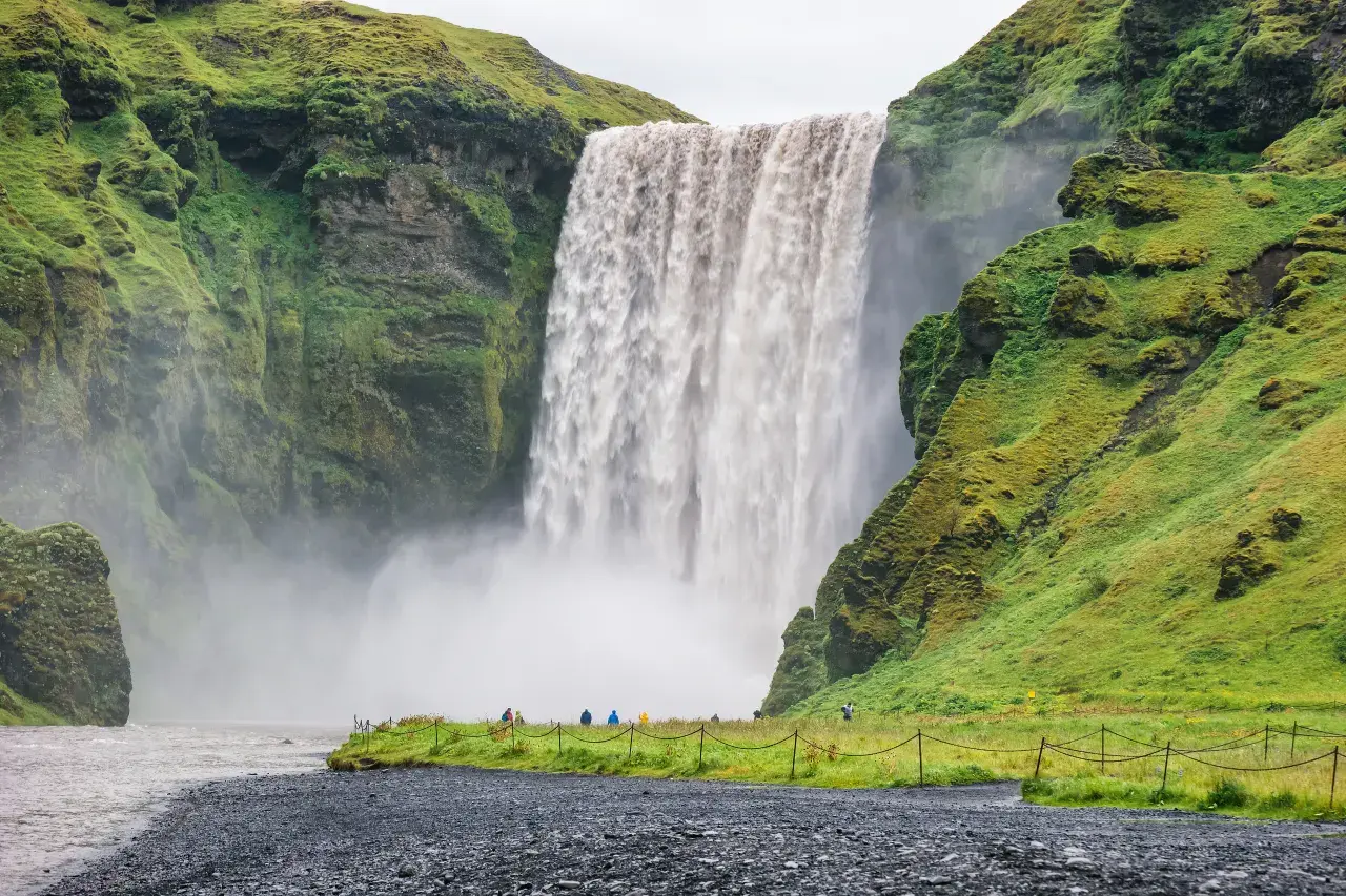
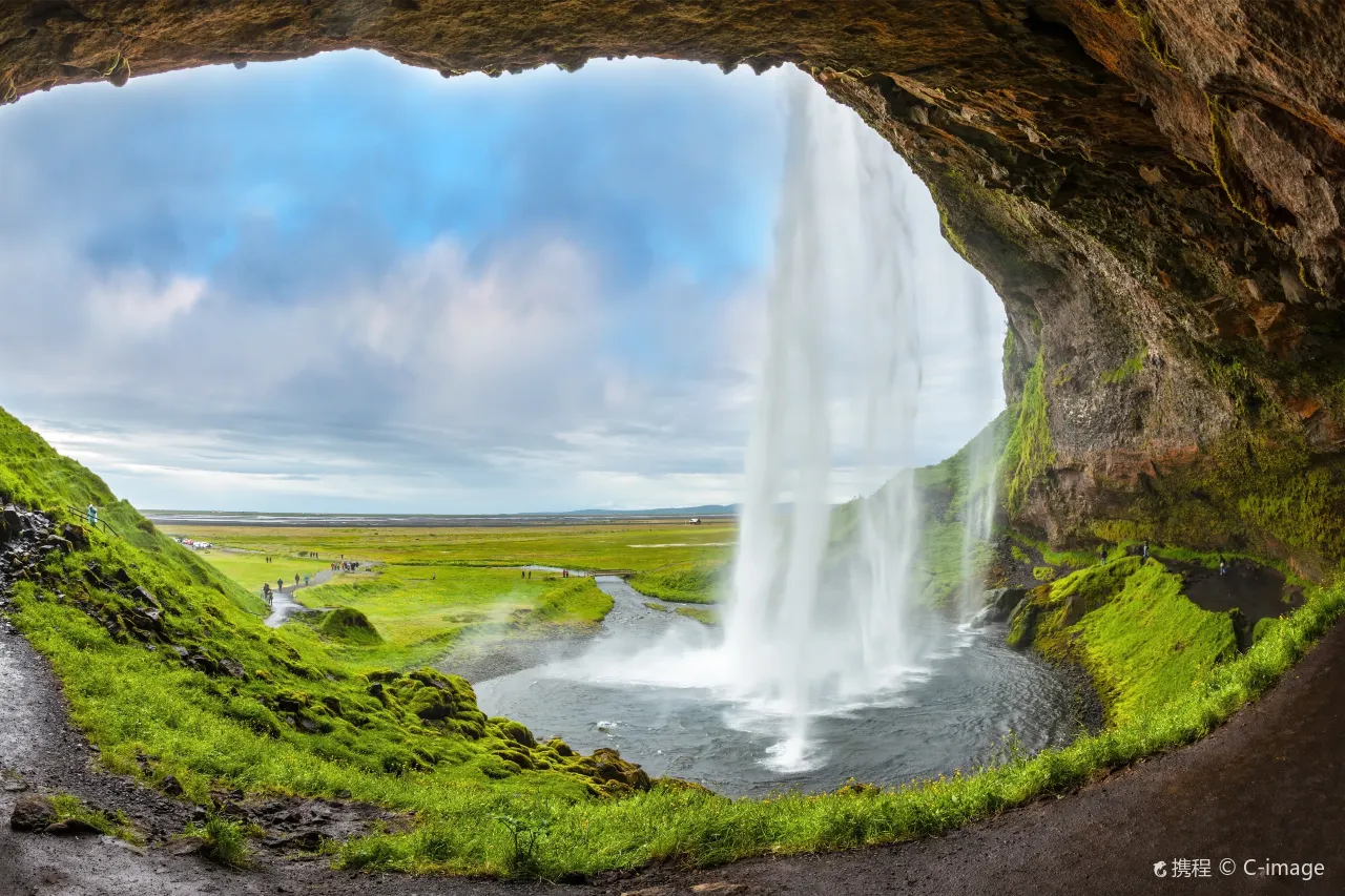
The traverse is a serious day: long, steep, exposed to weather at the pass, and best attempted with an early start and a flexible return plan (buses connect both ends in season). Snow lingers into early summer and can return early in autumn. On the valley side, the descent drops into Þórsmörk’s green — a finale that makes the Skógar-to-Þórsmörk direction our favorite. And on the drive toward either end, the south coast’s classics line the way: Skógafoss at the trailhead and Seljalandsfoss just west, which brings us to the valley’s front door.
Weather, rivers & safety habits
Þórsmörk’s safety brief is short and absolute. Weather: mountain forecasts differ from Reykjavik’s, the valley’s shelter can end abruptly above the treeline, and storms arrive with little negotiating room — check en.vedur.is and the Veður app, and file your plans with safetravel.is before heading out. Rivers: the Krossá and its tributaries are glacial, fast and lethal cold; the footbridges exist so you never need to test them, so never wade anywhere else. Emergencies: 112 covers everything, and the 112 Iceland app gives rescuers your exact location when signal is thin.
The honest trade-off section: Þórsmörk in poor weather is a valley of fog and dripping tents, not postcards. Build slack days, carry full layers even on the shortest day hikes, and treat the huts’ wardens as living guidebooks — their read on the Krossá, the pass and the coming front is worth more than any forecast model. Go with that humility and the valley gives back everything the brochures promise.
Frequently asked questions
Can you drive your own car to Þórsmörk?
No — not to the valley itself. The Krossá’s braided channels require modified highland buses, and the access tracks are closed to ordinary vehicles with strict 4×4 rules beyond the lowlands. The scheduled summer buses from the Reykjavik and Hvolsvöllur directions are the way in; book ahead in July and August.
When is Þórsmörk accessible?
Summer only, roughly the main summer season when the highland bus routes operate. Outside that window the tracks close and the huts shut down; winter visits are expedition-grade undertakings rather than travel plans. Verify exact season dates with the bus operators and road.is each year.
How hard is the Fimmvörðuháls traverse?
It is a demanding but non-technical day: around 16 kilometres with sustained climbing, 23 waterfalls on the Skógar side, and full weather exposure at the pass between the two glaciers. Fit hikers manage it comfortably in good conditions; the risks come from wind, lingering snow and late starts, not from the trail itself.
Do I need to book the huts in advance?
Yes — Langidalur and Básar fill months ahead for July and August, and the Laugavegur’s popularity keeps shoulder-season beds tight too. Campsites are the fallback for flexible travelers, but designated-sites-only rules apply and gear must be self-sufficient.
Is Þórsmörk suitable for beginners and families?
For motivated beginners, yes — the bus access means no technical skills are needed, and hikes like Valahnúkur (about 1–1.5 hours) deliver the full experience in half a day. Families with children do best based at Básar with its riverside campsite, keeping to marked trails and treating the footbridges as the only river crossings.
Chain the big routes together
Þórsmörk is one anchor of Iceland’s greatest hiking network — plan the highland half with our guides.
Before and after the valley: the trailheads and waterfalls of the south coast are covered in our Skógafoss guide Und Seljalandsfoss guide, the ice that frames the valley in our glaciers & ice caves guide, and the wind math that decides your hiking days in the weather & wind guide.
Sources & official references
- Official Icelandic services: safetravel.is (trip plans, mountain safety), road.is (highland track status), en.vedur.is (mountain weather forecasts) — checked 2026.
- Hut and route operators: Ferðafélag Reykjavíkur (Langidalur) and Ferðafélag Árnesinga (Básar) booking and season information, as published for 2025–2026.
- Highland bus operators: seasonal schedules over the Krossá from the Reykjavik and Hvolsvöllur directions, 2025–2026; verify live dates when booking.
- Trip.com Iceland destination guide (checked 2026): Þórsmörk overview, trail listings and regional itineraries.
- Editorial visits by the Iceland Travel Guides team across seasons, most recently 2025–2026.
