
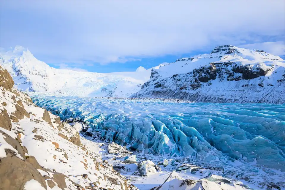
Vatnajökull National Park is not a stop — it is a country-sized fact. At roughly 14,000 km² it is Europe’s largest national park by area, wrapping Europe’s largest ice cap and everything the ice touches: glacier tongues, ice caves, the Jökulsárlón lagoon, waterfalls like Dettifoss and Svartifoss, canyons, highlands and coastline. The Trip.Best list gives it heat 7.5 and 4.9/5 from verified visitors — and the “fire and ice” badge — because the park is where Iceland’s two defining forces share the same frame.
This is #7 of 39 in our Best Things to Do in Iceland guide. The park is too large for one post, so this is the field guide to its logic: the three gateways most visitors use, what each delivers by season, the free-access rules, and how the ranked experiences inside it (#2 ice caves, #3 Diamond Beach, #29 Skaftafell) chain together.
Key takeaways
- 14,000 km² of protected land: Europe’s largest national park — larger than some countries; it wraps the entire Vatnajökull ice cap.
- Three gateways matter: Skaftafell (south), Jökulsárlón (southeast), and the Mývatn–Dettifoss side (north) — most trips touch one or two.
- Entry is free: no gate fees; parking and guided activities are the only costs.
- Game of Thrones shot here: the Svínafellsjökull glacier tongue doubled for the Wall — filming locations are part of the draw.
- Winter and summer are different parks: ice caves and aurora in winter; hiking trails, boat tours and the highlands in summer.
Quick answer: Choose your gateway by season and drive-time: south (Skaftafell) for glacier walks and Svartifoss, southeast (Jökulsárlón) for the lagoon, Diamond Beach and the winter ice caves, north (Mývatn/Dettifoss) for the canyon and bath country. Give the park a full day minimum, two if the ice caves or boat tours are on the list, and remember the whole thing is free to enter.
One park, three landscapes
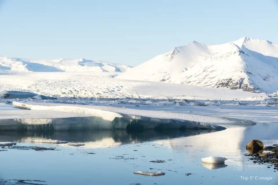
Vatnajökull the ice cap covers ~7,700 km² — more than 7% of Iceland — and sits above active volcanoes (Grímsvötn, Bárðarbunga, Öræfajökull), which is why “fire and ice” is the park’s literal condition, not marketing. The park wraps the ice and its outlets: on the south, glacier tongues run from the highlands to farmland; on the northeast, the Jökulsá canyon carries meltwater to Dettifoss; on the southeast, the Breiðamerkurjökull tongue feeds the Jökulsárlón lagoon and Diamond Beach.
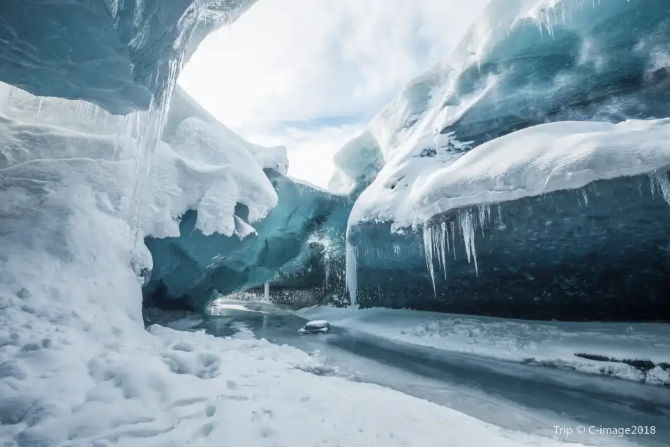
The park’s scale explains its listing style: rather than one attraction, it is the container that holds four ranked experiences — the blue ice caves (#2), Diamond Beach (#3), Skaftafell (#29) and, on the northern edge, the Mývatn country (#35, #39). Plan it as a region with a base (Höfn, Vík or the Mývatn cluster), not a day trip.
The volcanoes under the ice: Grímsvötn and Bárðarbunga erupt beneath the cap, and the meltwater floods (jökulhlaup) they trigger reshaped the floodplains you drive across. The park’s visitor centres explain the system — worth twenty minutes before the trailheads.
The three gateways, by season
South gateway — Skaftafell (#29): the park’s classic hiking country. Svartifoss (the basalt-column fall), the walk-up glacier face at Skaftafellsjökull, the Svínafellsjökull Game of Thrones tongue, and summer trail networks toward Kristínartindar. Works every season; the glacier hikes run year-round.
Southeast gateway — Jökulsárlón: the lagoon with its iceberg fleet, amphibian and zodiac boat tours (summer), Diamond Beach (#3), and the winter blue ice caves (#2). The highest-density photography in the country. Works year-round; boats and caves are seasonal.
North gateway — Mývatn–Dettifoss: the park’s northern side. Dettifoss (Europe’s most powerful waterfall by volume), Ásbyrgi canyon, and the geothermal country around Mývatn — nature baths (#35) and Krafla (#39). Access from Akureyri/Egilsstaðir; winter reduces the Dettifoss east road but the west side stays plowed.
Access, costs and the rules that matter
The park has no entrance fee — Iceland’s national parks are free, with paid parking at the developed sites (Skaftafell, Jökulsárlón, Dettifoss). The rules that matter: drones are banned or restricted across most of the park (permit territory — our photography guide’s drone section covers it), off-road driving is illegal everywhere, and the glacier travel is guide-only. Wild camping is restricted; the Skaftafell campsite is the legal base.
Visitor centres at Skaftafell and (seasonally) Glífr/Vatnajökulsþjóðgarður stations carry trail conditions and ranger advice; safetravel.is and road.is are the daily-check sources in winter. Winter driving on the south coast is real-world winter: check the forecast twice, keep daylight margins, and never chase the ice caves without a tour booking.
Drone rules: the park’s drone restrictions are enforced — most of Vatnajökull NP is closed to drone flight without permits. The 120 m national baseline still applies where flying is allowed; the park-specific bans come first.
Seasons in the park
Summer (June–August): every trail open, boat tours running, the highland roads into the park’s interior accessible, midnight-sun light for long days. Autumn (September–October): the colours, thinning crowds, highland windows closing, first aurora. Winter (November–March): the ice caves, snow-covered glacier fronts, aurora, and reduced access — the south coast road stays open through winter (check road.is), the interior does not.
The shoulder sweet spot: September is the park’s best single month — trails still open, the lagoon calm, first dark nights for aurora over the ice, and the summer crowds gone. February is the winter counterpart: cave season, clear post-storm windows, and the lagoon frozen at its edges.
Field report: our team’s benchmark park day: Skaftafell sunrise at Svartifoss (empty), the glacier walk-up by 10:00, Jökulsárlón by 14:00 with the boat tour, Diamond Beach at 17:00 golden hour — four ranked stops, one September day, one park. The geography is that compressed.
How it fits an Iceland route
On the Ring Road, the park is the anchor between Vík and Egilsstaðir: 2 hours Vík → Skaftafell, 40 minutes Skaftafell → Jökulsárlón, then the east fjords beyond. Ring Road itineraries give it 1–2 days; dedicated photography or cave trips give it 3. Our Jökulsárlón guide, Skaftafell coverage within the park post, glaciers and ice caves guide, and the Ring Road guide chain the whole region.
Frequently asked questions
How big is Vatnajökull National Park?
Roughly 14,000 km² — the largest national park in Europe, covering the whole Vatnajökull ice cap and its surroundings from the south coast to the northeast canyons. It was formed in 2008 by merging Skaftafell and Jökulsárgljúfur with the ice cap itself.
Do you pay to enter?
No — entry is free. Paid parking applies at developed sites (Skaftafell, Jökulsárlón, Dettifoss), and guided activities (glacier hikes, ice caves, boat tours) are separately priced.
How many days do you need?
One full day covers one gateway properly; two days let you chain the southeast triangle (lagoon, beach, caves) or south trails with the north side. The park rewards base-camping at Höfn, Vík or Mývatn rather than day trips from Reykjavík.
Where was Game of Thrones filmed in the park?
The Svínafellsjökull glacier tongue near Skaftafell doubled for the Wall beyond-the-Wall scenes. It is visible from the Skaftafell trail network — one of several Icelandic locations, alongside Þingvellir (#18) and Grjótagjá cave near Mývatn.
Where this ranks — and what is next
Vatnajökull National Park is #7 of 39 in our Best Things to Do in Iceland guide — the full ranked list, built from Trip.Best traveler data, lives in one place.
Go deeper: Glaciers and ice caves — the complete guide, Skaftafell: the park’s hiking gateway (#29), Jökulsárlón glacier lagoon complete guide.
Sources & official references
- Trip.com listing for Vatnajökull National Park: 4.9/5 rating, saved-by data (checked November 2026).
- Trip.Best ranking data: heat 7.5, #7 of 39; “Fire and Ice” theme badge (November 2026).
- Vatnajökull National Park official information: area, rules, drone policy (checked 2026).
- Park visitor centre briefings and editorial visits across seasons, 2023–2026.
